Cát Bà, Hải Phòng · Nature
Hòn Bút
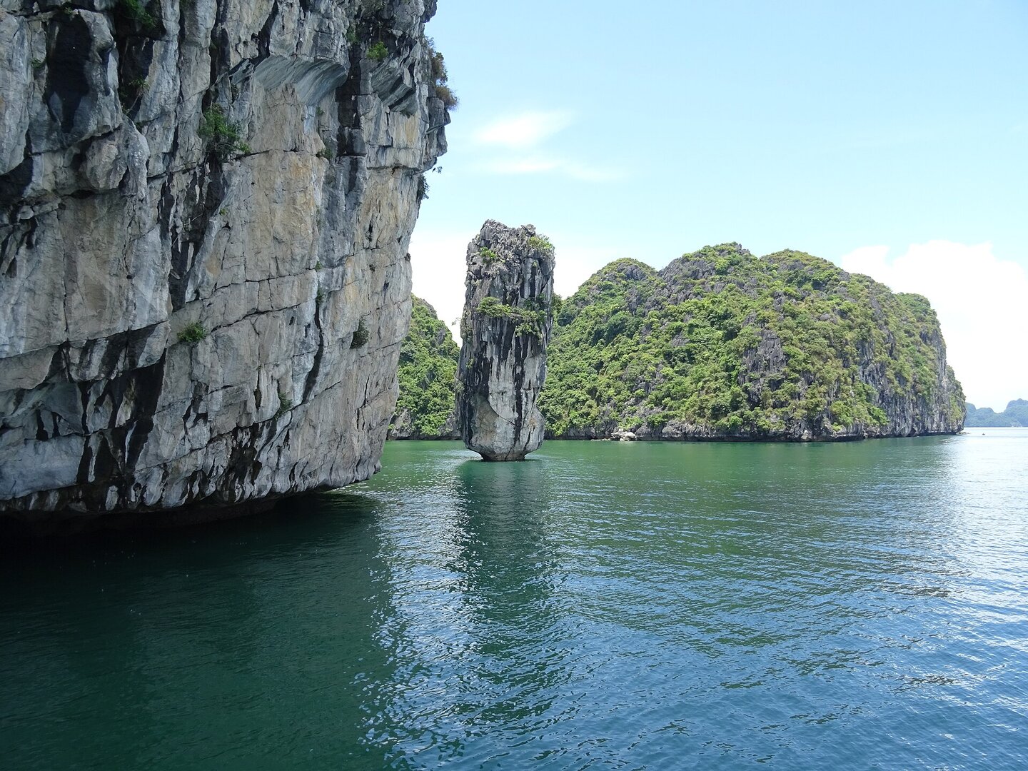
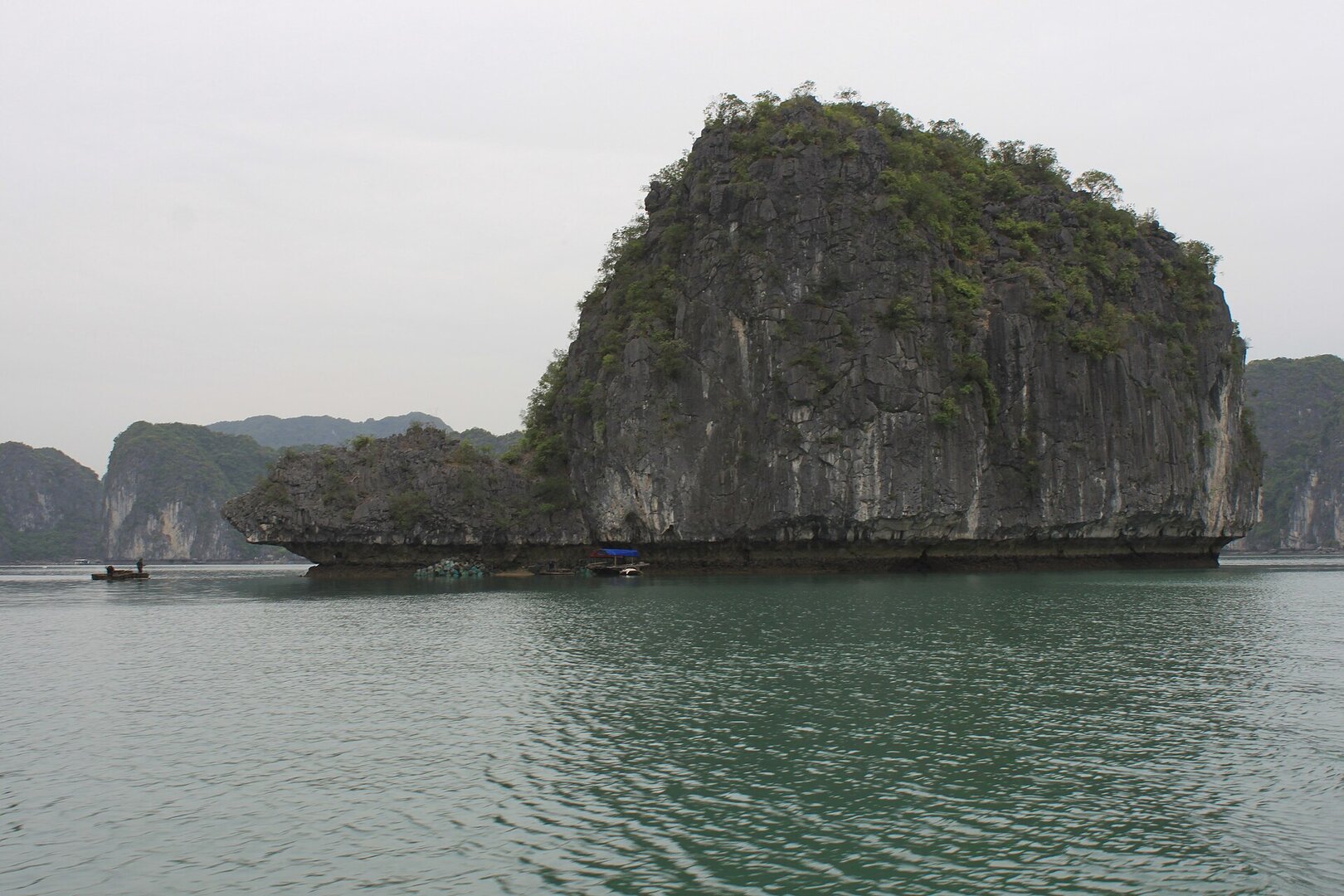
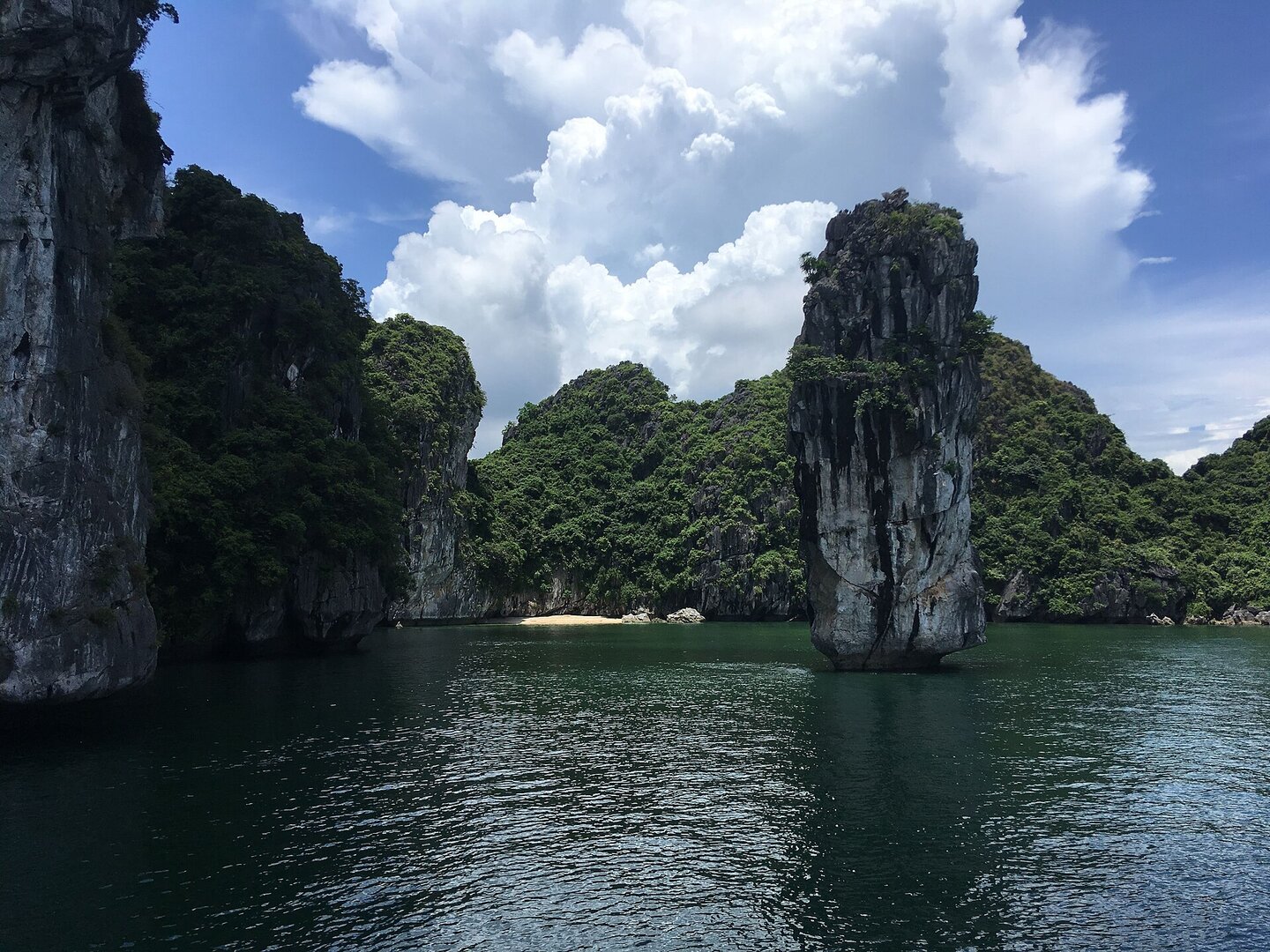
A cylindrical limestone column about thirty metres high standing alone in Lan Hạ Bay, its base cut by waves into a notch, so it looks like a pen. It can be viewed only from a boat out of Cát Bà.
Photo: Christophe95 · CC BY-SA 4.0
What people come for
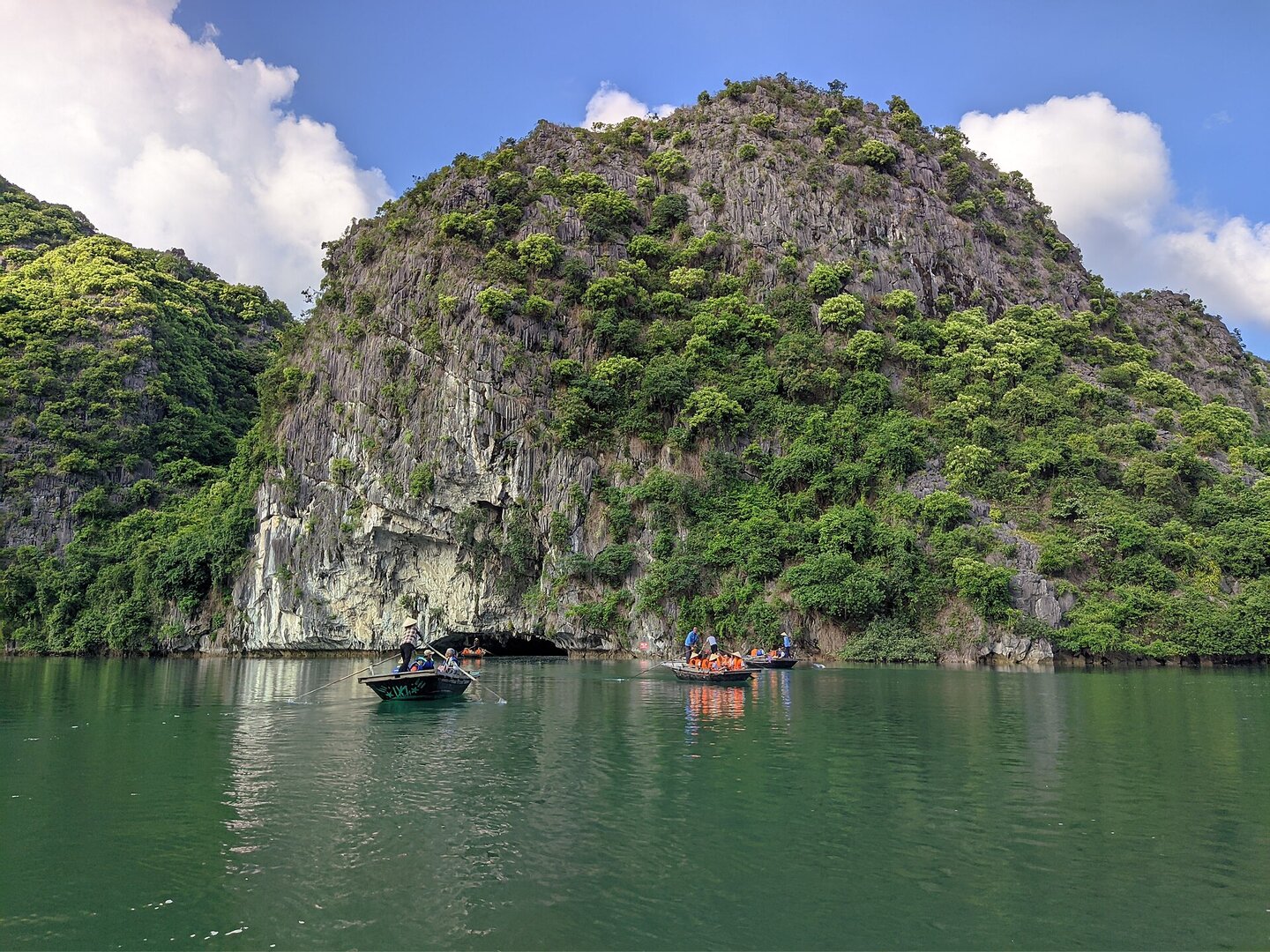
Hòn Bút is a viewing point on the discovery boat route of Lan Hạ bay, along with hòn Con Rùa, hòn Ba Trái Đào, hòn Bụt Mọc and hang Sáng Tối. It has not become a symbol of the bay like hòn Trống Mái in Hạ Long, and it is also a place for experienced free climbers, not for ordinary visitors.
Christophe95 · CC BY-SA 4.0 · source
Getting there and around
There is no road: it can only be viewed from a boat or vessel departing from Cát Bà island, and tours may change or skip the Hòn Bút stop depending on weather and tide. There is a sightseeing fee for the bays of the Cát Bà archipelago, not counting the boat fare.
Before you go
The foot of the islet is being eroded by seawater and is at risk of collapsing into the sea. There is no source on the results of any later survey or reinforcement, so do not approach closely, anchor or swim under the undercut. When there is a storm, tours and accommodation on Lan Hạ bay are halted. The storm season falls from midsummer into early autumn (Vietnam Maritime Search and Rescue Coordination Centre), while in late autumn the sea around Cát Bà is usually calm.
What this place is
Hòn Bút is a cylindrical limestone mass about thirty metres tall, standing alone on Lan Hạ bay (Hải Phòng), part of the Hạ Long Bay – Cát Bà Archipelago World Natural Heritage site. Waves have eroded the foot of the islet into an undercut, so the rock looks like a pen; fishermen also call it hòn Tháp Nghiêng (Leaning Tower islet). As of May 2026 the rock still stands in the middle of the bay, shaped like a giant pen rising from the blue sea.
Photographs
3 of 3 on fileThe story
Hòn Bút: a stone pen wearing away in Lan Hạ Bay
Picture a pen stuck upright in the sea. The shaft is a cylinder of limestone, roughly thirty metres tall. Its base has been cut by waves into a deep notch, which Vietnamese call hàm ếch ("frog's jaw"). Seen from a boat, the whole mass seems to lean. This small rock islet stands in Lan Hạ Bay, Hải Phòng, within the Hạ Long Bay – Cát Bà Archipelago natural World Heritage Site. Nobody built it. People only named it: local authorities call it Hòn Bút ("Pen Islet"), while fishermen and some visitors call it Tháp Nghiêng ("the Leaning Tower"). Both names describe the same shape, and that shape exists because of the very base that is being worn away.
Vibe
Tags
Source
Identity and coordinates were cross-checked against the Google Maps page of the entity 'Hòn Bút', read with a browser in Oct 2026. The OSM node 'One pillar rock' could not be reopened and so was not used. The names (Hòn Bút, Tháp Nghiêng), the position in Lan Hạ Bay, the shape of the rock, the risk of the base of the islet collapsing, and the fact that this place lies on the boat route and is a free-climbing spot all come from a Thanh Niên article of 30 Oct 2023. That the rock is still standing comes from Hải Phòng newspaper of 29 May 2026. The stopover schedule changing with the weather comes from the Cát Bà Express tour page (undated). The bay's visiting fee comes from VnEconomy of 6 Nov 2025, which says only that a fee is charged, without the amount. The wind season, storm season and winter fog come from the Gulf of Tonkin climate page of the Vietnam Maritime Search and Rescue Coordination Centre (undated). Calm seas in late autumn come from Diễn đàn Doanh nghiệp (2022). The busy and quiet rhythm of Cát Bà island comes from a VnExpress guide (2022). The rule that tours stop when there is a storm comes from the English edition of Dân trí of 24 Aug 2026, matching Pháp Luật TP.HCM and VTV in 2025. Rejected: the names Hòn Chuông, Hòn Nến and Bắp Chuối (only one tour page, possibly a different islet); describing it as 'belonging to Hạ Long Bay' (an undated page, inconsistent with the Google Maps position); the 2018 fee (outdated); the boat travel time (no travel figures given); news items about individual storms or individual boat accidents (merged into a general rule, or unrelated to Hòn Bút). Photos: three by Christophe95 on Wikimedia Commons, licence CC BY-SA 4.0, taken on 6 Aug 2018.
Place data is compiled from many sources across the internet by a team of automated AI agents that collect, enrich, check, challenge, score, edit, review and verify it.






Ratings & comments
Anyone can read. Sign in to rate, comment and like.