TP. Hồ Chí Minh · Attraction
Cu Chi Tunnels
Picture yourself just out of the cinema after "Địa đạo: Mặt trời trong bóng tối", and then one day standing in the forest, looking down at a mound that looks like a termite hill, knowing there may be a passage underneath.
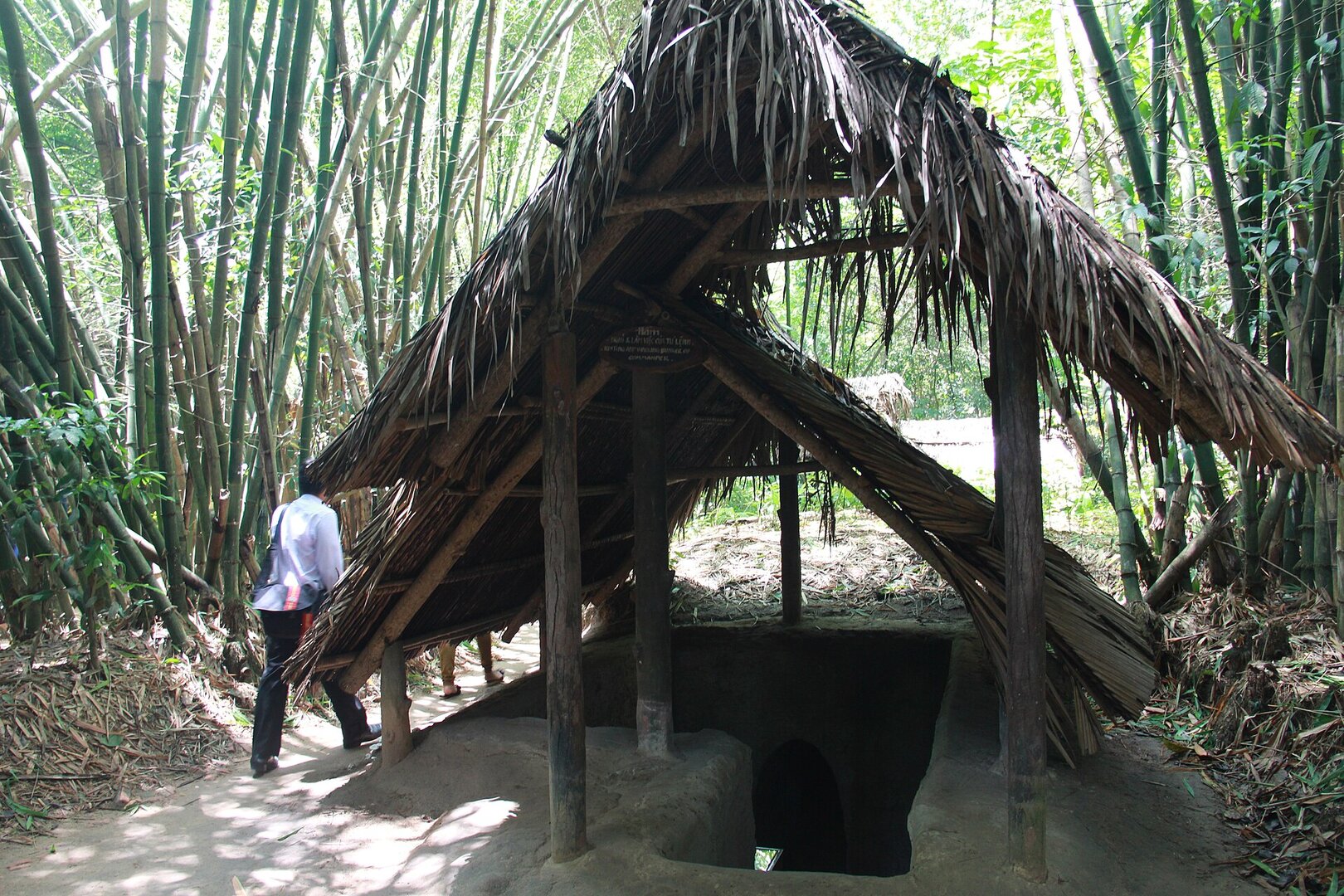
Picture yourself just out of the cinema after "Địa đạo: Mặt trời trong bóng tối" (literally "Tunnels: Sun in the Dark"). Director Bùi Thạc Chuyên's film is set in the Củ Chi tunnels; it opened in early April 2025 and became a box-office craze. Then one day you are standing in the forest. At your feet is a small mound of earth, like one pushed up by termites. The tunnel hatches were camouflaged to look exactly like that. Air holes run along the tunnels, and the passages are only wide enough for one person walking bent over. The screen has finished its story. The real ground is still here.
After the film, the real ground is still there
The earliest tunnel sections in Củ Chi date from 1948, during the resistance war against the French, in two communes, Tân Phú Trung and Phước Vĩnh An. They were short stretches for hiding documents, weapons and cadres. Around 1961–1965 the communes of northern Củ Chi completed a main trunk tunnel known as the "backbone" (xương sống). Agencies and units dug branches into it, until hundreds of kilometres of underground passages linked the communes and hamlets into an "underground village". Some sections have two or three levels: the upper one called "thượng", the lower one "trầm", connected by secret hatches. Are you curious how people hid an entire village beneath their fields? They dug with hoe blades and carried soil out in bamboo baskets. The spoil was dumped into flooded bomb craters, shaped into termite-like mounds, or spread over the fields, ploughed in and planted with crops so no trace remained.
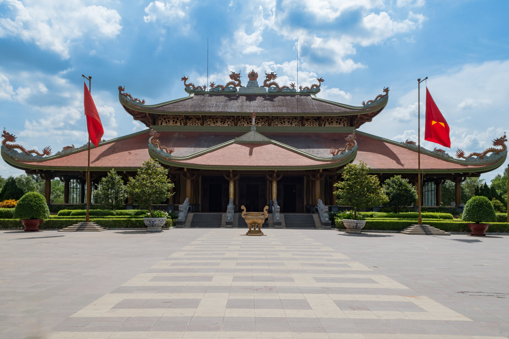
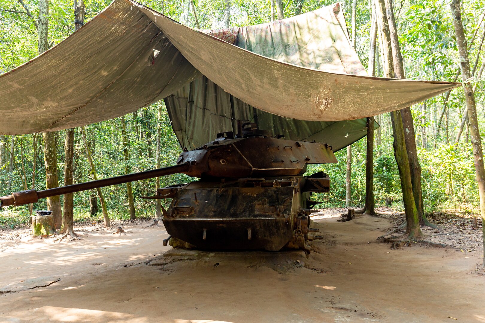
Today the tunnels are preserved at two separate sites about 13 km apart. The map pin sits at Bến Đình, the base of the Củ Chi District Party Committee (Huyện ủy) from 1968 to 1975. It was chosen for its forest of trích trees spreading over more than 100 hectares, its high, firm ground that rarely caved in, and its position on the Saigon River, which offered a retreat towards the water during raids. Here you walk a tunnel that passes beneath Provincial Road 15 and see where the committee lived and met, a weapons workshop and a tangle of trenches. In the middle of the forest lies the wreck of a US Army M41 tank that hit a guerrilla mine in 1970. The other site, Bến Dược, was the base of the Regional Party Committee (Khu ủy) and the Military Region Command of Saigon – Chợ Lớn – Gia Định, with a surgery bunker, A-frame shelters built to resist cave-ins, a Hoàng Cầm kitchen designed to hide cooking smoke, and the Martyrs' Memorial Temple. Both sites are open to visitors and charge an entrance fee.
So what do these tunnels say today? In spring 1968, liberation forces set out from this tunnel area to attack Saigon. The base area was also where Nguyễn Văn Linh, Võ Văn Kiệt, Trần Bạch Đằng and Mai Chí Thọ once lived and worked. But the closest answer is on the stone walls of the Bến Dược temple, which carry the name of Nguyễn Vĩnh Bảo — composer and Hero of the People's Armed Forces, a Hanoi man who volunteered to go south and was killed by American bombs on the Củ Chi front in June 1967, aged 31. People still come to burn incense and to look for the names of relatives and comrades on the stone tablets. Once you have crouched through a passage just wide enough for one person, how differently will you watch that film again, and look at the ground beneath your own feet?
Photographs
10 of 10 on filePhương Huy· Public domain (PD-self) · source
Matthew Blissett· CC BY-SA 3.0 · source
Jorge Láscar from Australia· CC BY 2.0 · source
Ludovic Lubeigt· CC BY-SA 2.0 · source
Jorge Láscar from Australia· CC BY 2.0 · source
Jorge Láscar from Australia· CC BY 2.0 · source
Lars Curfs (Grashoofd)· CC BY-SA 3.0 NL · source
Andre Hospers· CC BY-SA 4.0 · source
Alan & Flora Botting· CC BY-SA 2.0 · source
Ganesh Dhamodkar· CC BY 4.0 · source
Enough to decide whether to go
- What it is
- A wartime tunnel network preserved at two sites: Bến Đình and Bến Dược
- Dates from
- Earliest sections 1948; ranked a Special National Monument in 2015
- Bến Đình (map pin)
- Ấp Bến Đình, xã Nhuận Đức, Ho Chi Minh City (ấp = hamlet, xã = commune)
- Bến Dược
- Ấp Phú Hiệp, xã An Nhơn Tây, Ho Chi Minh City; about 13 km from Bến Đình
- Most worth seeing
- Bến Đình: the tunnel under Provincial Road 15, the M41 tank wreck in the forest. Bến Dược: the Martyrs' Memorial Temple
- Today
- Both sites open to visitors; entrance fee charged
From someone who has been
The two sites are not in the same place, so if you only have time for one, choose by what you want. Bến Đình is for the forest and the tunnels. Bến Dược is for the Memorial Temple and the Liberated Zone re-creation area, which is a reconstruction, not an original relic. Some tunnel stretches are so narrow you have to squeeze through sideways; anyone uneasy in tight spaces should know beforehand. It suits people who have seen the film and want to compare it with the real place, and families looking for a relative's name.
Vibe
Tags
Source
Most facts come from the website of the Củ Chi Tunnels Historical Site (diadaocuchi.com.vn), read on 8 Oct 2026: the name, the two zones Bến Dược and Bến Đình, the address, the national-monument ranking milestones (Bến Dược 1979, Bến Đình 2004), the first tunnel sections in 1948, how the tunnels were dug and their structure, the features of each zone, the Bến Dược Martyrs' Memorial Temple, the Liberated Zone recreation area, opening hours, the fact that tickets are charged and the phone number. The Special National Monument ranking milestone in 2015 and the names of the leaders who lived in the base area come from Sài Gòn Giải Phóng newspaper. The distance between the two zones and the Hoàng Cầm kitchen come from VnExpress. The milestone of the Spring 1968 attack on Sài Gòn and the honorific title of the Củ Chi land come from Báo Lào Cai. The story of the composer Nguyễn Vĩnh Bảo comes from Nhân Dân newspaper. The film ‘Địa đạo: Mặt trời trong bóng tối’ (Tunnel: Sun in the Dark) comes from VietnamNet (11 Apr 2025). The joint management board of the two zones comes from Vietnamese Wikipedia. Coordinates come from Wikidata; the boundary of the Bến Đình zone and the points on the map come from OpenStreetMap. The dates of Operation Cedar Falls (8–26 Jan 1967) are independently confirmed by English Wikipedia; the results of the sweep, however, are only the historic site's own account. Information dropped because the sources contradict each other or there is only one source: the total length of the tunnels (200 or 250 km), the depth of each level, the number of martyrs' names engraved on the stele (45,666 or 44,520), the supervising body of the management board, and bomb and ammunition figures that only one article gives. Photos come from Wikimedia Commons, with author and licence given for each.
Place data is compiled from many sources across the internet by a team of automated AI agents that collect, enrich, check, challenge, score, edit, review and verify it.
Ratings & comments
Anyone can read. Sign in to rate, comment and like.