Cát Bà, Hải Phòng · Nature
Van Boi Beach
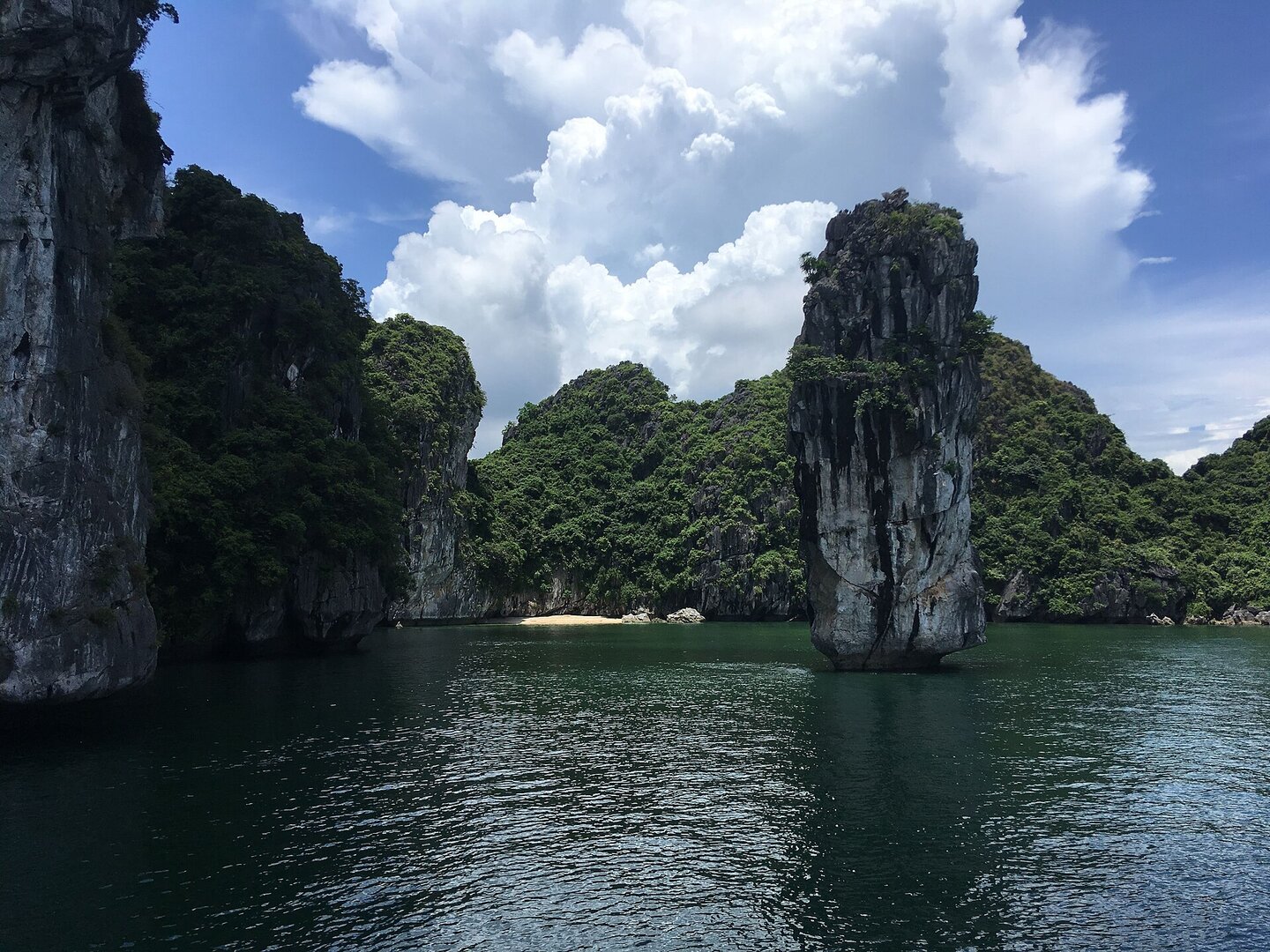
Picture a sightseeing boat in Lan Hạ Bay stopping beside a small forested limestone island, and the people on deck dropping into the water one by one to swim to a little strip of sand. That is Vạn Bội.
01What people come for
People come to swim and look at the limestone bay, as one leg of a Lan Hạ bay tour. One travel site says the water is clear enough to see coral, but there is no survey specifically for this beach. Kayaking is an activity of the bay tour, not a service at the beach, and kayak services on the Cát Bà bays were suspended from 15 Nov 2024; it is unclear whether they have reopened.
Getting there and around
Reachable only by boat, usually departing from Bến Bèo. You must buy a bay sightseeing ticket at Bến Bèo and pay for the boat or tour. Motorbikes, cars or ferries only take you to Cát Bà island, not to the beach. As the crow flies, the beach is about 3.5 km from Bến Bèo (measured on OpenStreetMap).
Before you go
The swimming season is summer, around May–August: the sea is calm but the bay is at its busiest. This is also the storm season, usually from June to September (VMRCC), so check the weather forecast before heading out to the bay. Around September–November the bay is calmer, the weather is cool, and swimming is still possible. The north-wind season from November to April is cold and dry, not a swimming season, and boats may be postponed when the wind is strong. The beach surface expands and shrinks with the tide; one visitor recounts a boat running aground when the water receded in the early evening (Google Maps review). No source says the beach has lifeguards or warning flags, so wear a life jacket, wear sandals and swim only in the sandy area. In summer the sea at Cát Bà may have jellyfish. Phone signal may be weak. Some days floating rubbish drifts onto the beach.
What this place is
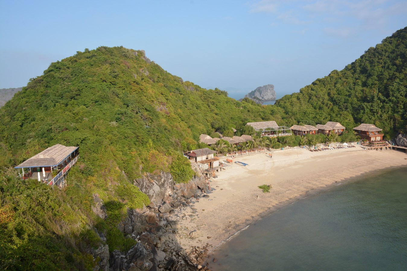
A small sand beach on a small, forested limestone islet in the middle of Lan Hạ bay, north-east of Cát Bà town and Bến Bèo. The beach is not on the shore of Cát Bà island. The sand is fine and the water clear. The water of Lan Hạ bay is usually still because it is sheltered by the limestone islands (Vietnam National Authority of Tourism, vietnam.travel).
Busy and quiet times
The beach is mainly where bay-tour boats anchor to let guests swim, and guests usually swim from the boat to the beach (Google Maps review), so it suits people who can swim. Around the beach there are barnacles clinging to the rocks and shell fragments that can cut your feet.
Eating
One Google Maps review says there are people selling food at the beach. No source says there are toilets, umbrellas or changing places.
The story
Vạn Bội Beach: a strip of sand nobody built, reachable only by boat
Picture a boat leaving Bến Bèo pier, heading north-east for roughly three or four kilometres as the crow flies, then stopping in front of a small limestone island covered in forest, in the middle of Lan Hạ Bay. At its foot lies a small beach of fine sand and clear water. No road leads here. To set foot on the sand, visitors usually swim in from the boat. So what has this place kept from an earlier time? Not a building. Limestone, forest, and a strip of sand that nobody built. What people have added is much lighter: they turned the beach into a stop where bay tour boats pause so passengers can swim, and they put a bay ticket at Bến Bèo between anyone and this spot.
Vibe
Tags
Source
Identity and location come from the Google Maps pin ‘Bãi tắm Vạn Bội’ (matching the coordinates in the database) and from OpenStreetMap. On OpenStreetMap, the pin sits inside a small forested islet of about 150×100 m in Lan Hạ Bay, part of Cát Hải special zone (cross-checked 12 Oct 2026). How to get in, the bay ticket at Bến Bèo, the swimming season and the early-autumn season come from VnExpress's Lan Hạ Bay guide (5 Aug 2023) and VnBusiness (13 Aug 2018). The storm season, the northeast monsoon (gió bấc) season and the diurnal tide regime come from the Gulf of Tonkin meteorology and hydrology page of the Vietnam Maritime Search and Rescue Coordination Centre (VMRCC); these are figures for the whole region, not measured at the beach itself. The line that the water is usually calm comes from the Vietnam National Authority of Tourism page (vietnam.travel) and speaks of the whole bay. Jellyfish come from VnExpress (3 Jul 2019). Coral and phone signal come from Vinpearl's promotional page (6 May 2025); VNA copied Vinpearl, so it is counted as one source only. The temporary halt of kayaking comes from Người Quan Sát (21 Nov 2024). Barnacles on the rocks, boats anchoring for guests to swim in, food sellers, floating rubbish and boats running aground when the water recedes all come from visitor reviews on Google Maps, from 2019 to about Aug 2026. The following claims were rejected: the figure ‘3 km from central Cát Bà’ (Vinpearl, then copied by Sun Paradise; measured at about 4 km); every claim of an author-less machine-translated page, including ‘8 km’, ‘southeast coast of Cát Bà island’, ‘no amenities’, ‘jellyfish May–August’ and ‘tours cancelled November–March’; the line ‘suitable for families with small children’ and the line ‘away from the noise’ from promotional pages; the advice not to climb the rocky hill, because that line belongs to Nam Cát island and not Vạn Bội; and every bus or ferry route ‘to the beach’, because the beach is a small islet of its own. There is no source yet on lifeguards, separate fees for the beach, or boats stopping during storms. The place has no photo for now: the open photo archive has no photo of this beach itself.
Place data is compiled from many sources across the internet by a team of automated AI agents that collect, enrich, check, challenge, score, edit, review and verify it.
Ratings & comments
Anyone can read. Sign in to rate, comment and like.