Mù Cang Chải, Lào Cai · Nature
La Pan Tan Rice Terraces
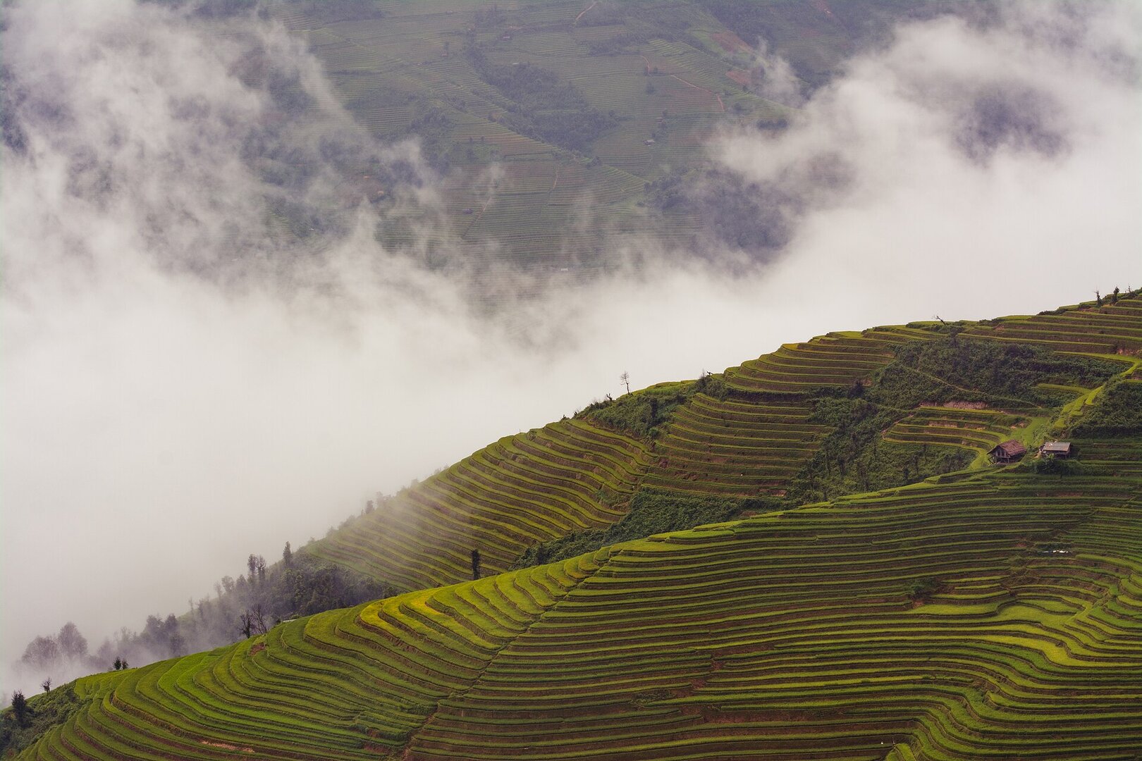
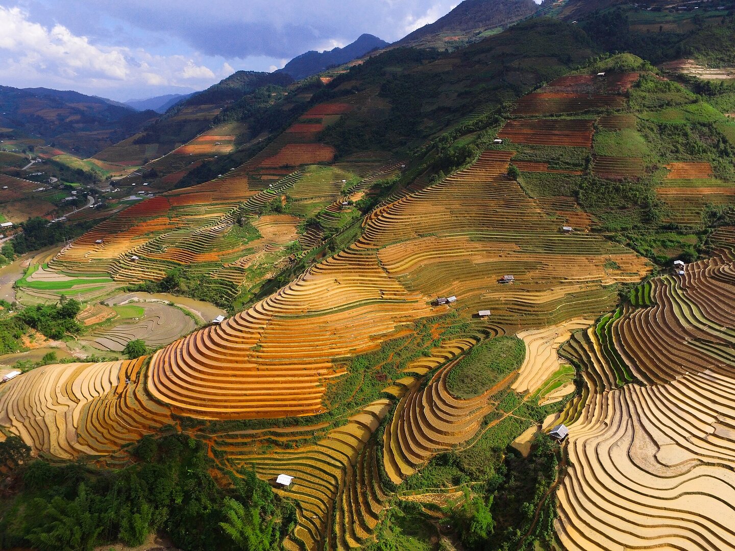
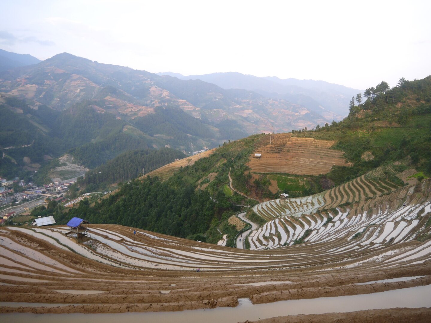
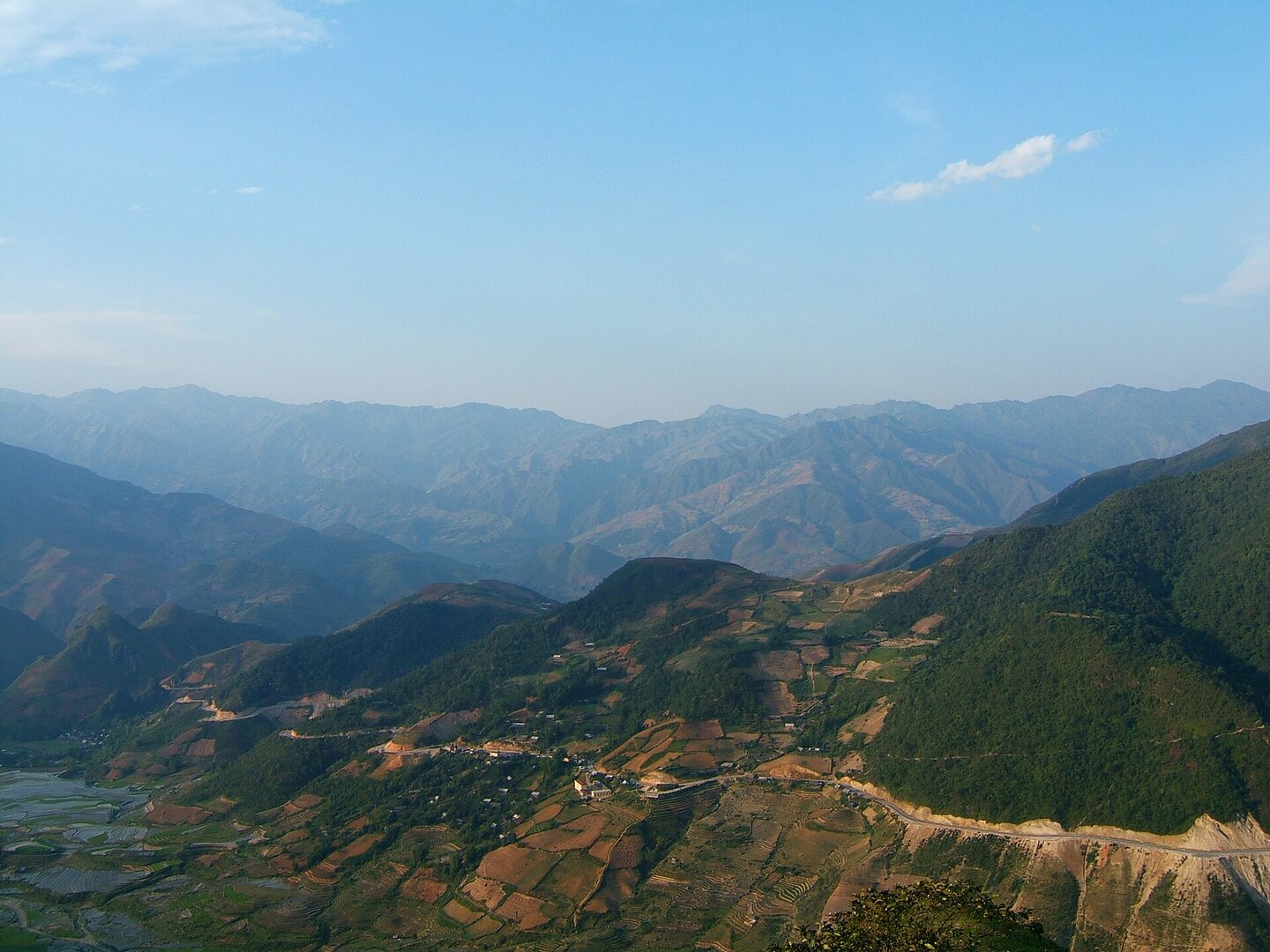
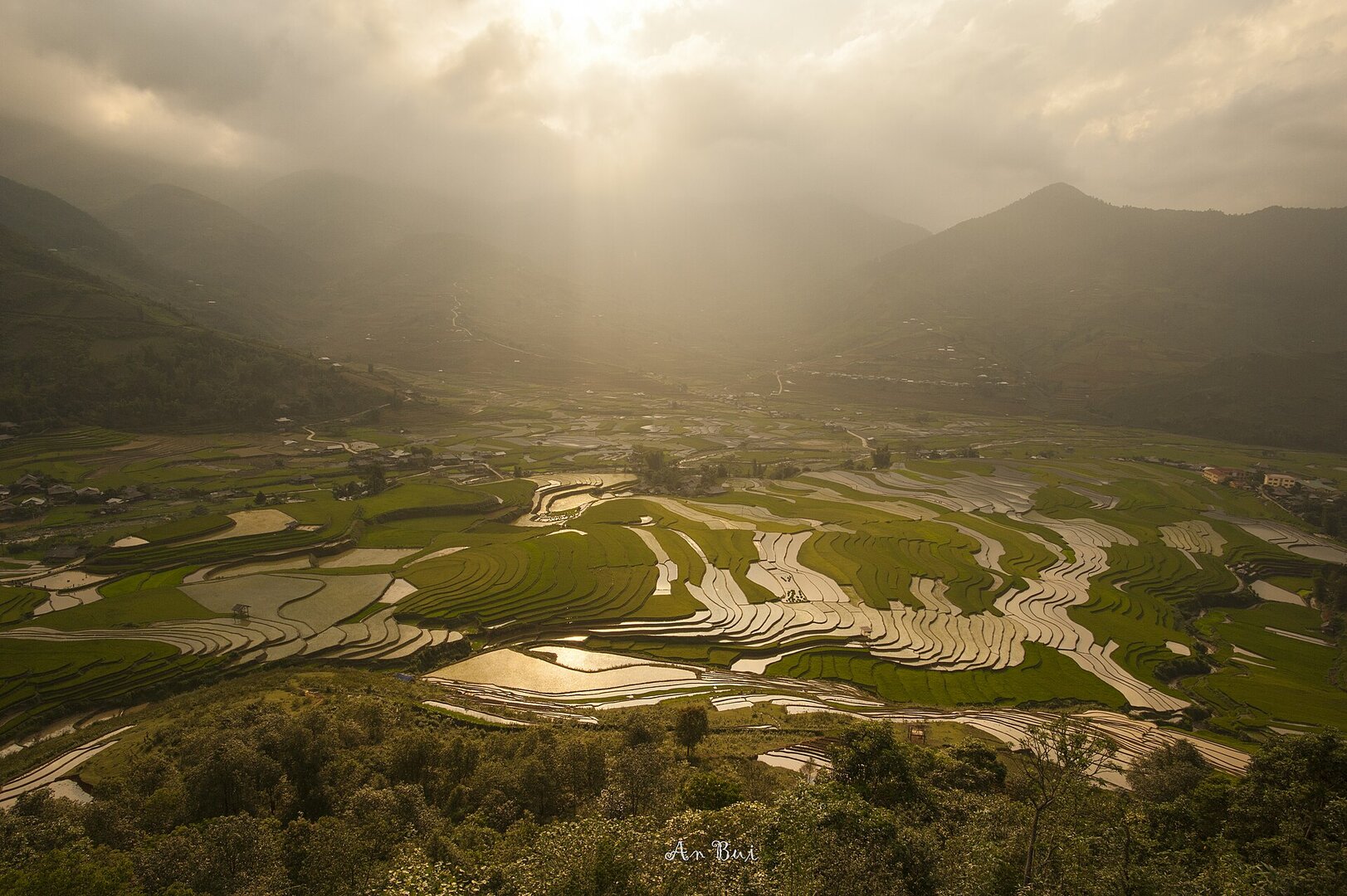
A terraced slope cultivated by the Hmong in La Pán Tẩn hamlet, inside the protected core zone of the Mù Cang Chải Terraced Fields special national monument. The landmark is a hill with spiral-shaped paddies, commonly called Mâm Xôi hill (the sticky-rice tray hill); the fields change their look completely with the season — mirror-like water at the end of May, glowing gold from mid-September.
Photo: Văn Ngọc Tăng (langthangdaydo) · CC0
What people come for
Two seasons. The water-filling season falls from late May to early June, when the first rains of the season arrive and the field surfaces become water mirrors stacked in tiers. The ripe-rice season comes later than in the Tú Lệ – Khau Phạ area: large fields such as La Pán Tẩn are at their most brilliant from mid-September to mid-October. During the day the fields are mentioned as most beautiful at sunrise and sunset, and the afternoon is quieter (Lào Cai provincial portal).
Getting there and around
By road, the area in practice has only one main route, National Highway 32 over the Khau Phạ pass; Đồi Mâm Xôi is about 8 km from the centre of Mù Cang Chải. The road up the hill is steep, slippery and has many dangerous bends, so in practice it is common to leave your vehicle at the bottom and then walk or hire a local motorbike taxi to take you up. This describes the road, not a ban on vehicles. On site there is an entrance ticket at a very low level, plus a few small extra charges for going up to the photo shelter or walking into the middle of the fields; no state agency publishes the current fee level, so no figure is given. Local people also rent ethnic costumes, and since 2026 there has been a photo service set up on the hill.
Before you go
The beautiful seasons coincide with the rainy season. Rain in the Northwest runs from May to the end of September, heaviest in July–August, with the risk of flash floods, landslides and falling rocks on the mountain pass roads. The flooded-field season and the start of the ripening season both fall squarely within it. National Highway 32 has repeatedly been cut by landslides right in the rice season: heavy rain from the night of 4 Jul 2026 to the morning of 5 Jul 2026 caused landslides at 19 points along the Km285–Km318 stretch, and Typhoon No. 10 in October 2025 swept away about thirty metres of road surface. These are seasonally recurring precedents, not today's conditions, so check the road status yourself before the trip. When it rains: do not stop the vehicle at the foot of an embankment or a rock face, and do not camp near streams; if you see rocks falling or water rushing down the mountainside, leave the area immediately, and the field banks are slippery. You can stay on the spot: around the fields there are stilt houses and homestays run by local people. No source says anything about rescue, a health post or mobile phone signal at the fields, and that silence should not be read as 'safe'.
What this place is
A mountainside of terraced fields on strongly fragmented terrain, so steep that farming has to be done in steps. The landmark is a hill with spiral-shaped plots, a round, evenly shaped mound that rises up, known as Đồi Mâm Xôi. The plots are very uneven: some at the foot of the hill or beside the stream are a hundred square metres across, while in other places people use a strip of roadside land just one or two square metres to transplant rice (Lào Cai provincial portal, special national monument dossier).
Busy and quiet times
These are fields farmed by local households, not a landscape put on display. Most residents of the heritage area are Hmong, and their new-rice celebration ritual here is a national intangible cultural heritage (Lào Cai provincial portal). If you want to take photos with local people, ask permission rather than assuming it. Mid-September to mid-October is the busiest period.
Photographs
1 of 1 on fileVăn Ngọc Tăng (langthangdaydo) · CC0 · source
The story
La Pán Tẩn Rice Terraces: An Old Fold in the Mountain, A New Life On It
Picture a mountainside so steep there is nowhere flat enough to lay down one straight furrow. No large river runs through it — only streams sliding off the Hoàng Liên Sơn range. On ground like that, people still grow rice: by cutting the whole hill into steps, letting water into the highest paddy and allowing it to spill down into the ones below. Some paddies are as wide as a courtyard; others are a strip of earth beside the path, barely enough for a few clumps of seedlings. In the middle of it rises one perfectly round hill, its terraces coiling around it in rings. People call it đồi Mâm Xôi — the Sticky Rice Mound — and in autumn it really does look like a golden mound of steamed rice.
Vibe
Tags
Source
This place profile was built from public sources and cross-checked across several layers. The monument status comes from Tuổi Trẻ (31 Dec 2021) and the Yên Bái provincial portal: Decision 1954/QĐ-TTg of 31 Dec 2019 classified the Mù Cang Chải Terraced Fields as a special national monument, and the ceremony to receive the certificate was held on 31 Dec 2021 — the monument page on the Lào Cai provincial portal recorded the certificate-presentation date as the issue date, and we have resolved that contradiction. The boundary of the protected zone, nearly 853 ha across 6 former communes, comes from Nhân Dân. The administrative unit comes from Resolution 1673/NQ-UBTVQH15: La Pán Tẩn commune was merged with Nậm Khắt, Dế Xu Phình and Púng Luông into Púng Luông commune, Lào Cai province, from 1 Jul 2025, so any mention of 'Mù Cang Chải district' or 'La Pán Tẩn commune' in older sources is only a quotation, not the current address. The description of the shape of the fields, the road up the hill, the 8 km distance and the on-site services come from Báo Lào Cai; the two seasonal milestones come from Tiền Phong (25 May 2026) and Dân trí (13 Aug 2026); the warnings about the rainy season and landslides come from VnExpress, Báo Lào Cai (5 Jul 2026) and Dân Việt (2 Oct 2025); the photo-taking services on the hill come from TTXVN (18 Mar 2026); the homestays from Báo Yên Bái (13 Dec 2023). What we LEFT OUT, and why: the ticket price of 20,000 VND and the motorbike-taxi price of 60,000–100,000 VND — they originate from articles of 2020–2021, and every 2026 page repeating exactly those figures is a travel blog copying from others, so we only say 'there is a fee, at a very low level'; the title 'top 10 most beautiful terraced fields in the world' — no source names the ranking organisation with a year; the black crested gibbon and the Mù Cang Chải Species and Habitat Conservation Area — the list of communes of the conservation area does not include La Pán Tẩn; the paragliding 'Flying over the golden season' — takes off and lands at Khau Phạ pass, not here; a separate area of '500 ha'/'700 ha' — found only on blogs and contradicting each other. Still open: the coordinates of the viewpoint have not been checked against the administrative boundary, and no agency publishes the current fee. Photo: Văn Ngọc Tăng (langthangdaydo), licence CC0, via Wikimedia Commons.
Place data is compiled from many sources across the internet by a team of automated AI agents that collect, enrich, check, challenge, score, edit, review and verify it.
Ratings & comments
Anyone can read. Sign in to rate, comment and like.