Dế Xu Phình, Púng Luông, Lào Cai · Nature
De Xu Phinh Rice Terraces
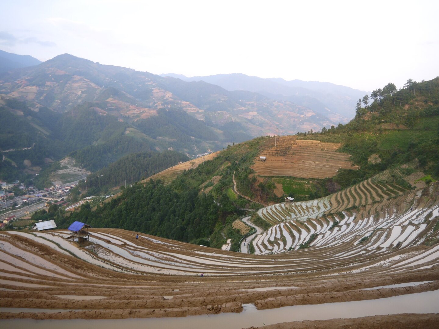
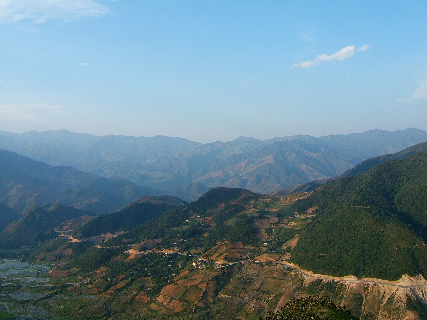
A mountainside below the Hoang Lien Son range where every contour is a field carved by Hmong farmers — now a special national monument, and still harvested every season.
Photo: Gió Đông (thảo luận) · Public domain (PD-self)
What people come for
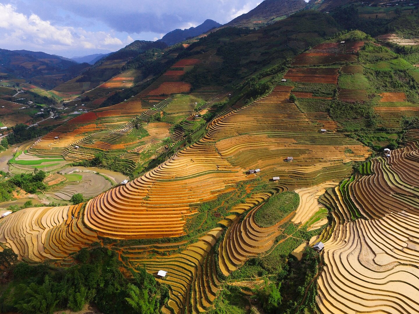
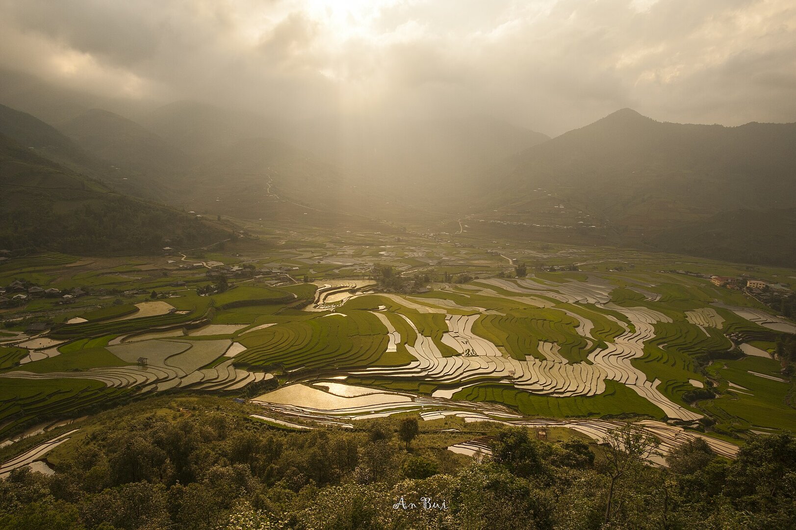
Two seasons. The water-filling season, around May–June, when villagers build up the banks and lead stream water into the fields and the surface reflects like a mirror — Dế Xu Phình is named by Báo Lào Cai together with La Pán Tẩn and Chế Cu Nha; this timing shifts from year to year because the fields wait for rain. And the golden season, when the rice starts to ripen from late September through October. During the day, the fields look best at sunrise and sunset (Lào Cai provincial portal).
VŨ HÙNG · CC BY-SA 3.0 · source
Getting there and around
There is only one main road into the terraced area: National Road 32 via Tú Lệ and the Khau Phạ pass — losing this route means losing the access. The area is about 300 km northwest of Hà Nội. The way up is a steep, winding mountain pass road; slow down on rainy days. To go down into the valley bottom at this stretch of fields you have to cross a bamboo bridge laid between two field banks — the bridge is slippery and has no handrail in the rain, and its condition may have changed since the article was written. These are villagers' fields: ask the owner before walking on the banks. No source says whether this stretch of fields charges an entrance fee, and that silence does not mean it is free.
Before you go
The Mù Cang Chải terraces, including the Dế Xu Phình fields, have been ranked a special national monument since late 2019; the fields of the three former communes of La Pán Tẩn, Chế Cu Nha and Dế Xu Phình had already been a national-level scenic site since 2007. The ranking decision names Dế Xu Phình commune, but the list of protected zones published by Lào Cai province after the mergers lists villages of the three new communes and does not include any village of this name — so it cannot be said for sure that this stretch of fields lies inside the current protection boundary. Dế Xu Phình is also no longer an administrative unit: from 16 Jun 2025 it merged with Nậm Khắt, La Pán Tẩn and Púng Luông to form Púng Luông commune, Lào Cai province. The season to avoid is the rainy season: this is an area that often suffers heavy damage from flash floods, torrents and landslides, and the rainy season overlaps the very start of the rice-ripening season. As of mid-Sep 2026, National Road 32 over the Khau Phạ pass is still passable but works are under way to repair 6 landslide points, with a completion target before 30 Sep 2026 — check the state of the route before travelling in the rainy season. There is no official guidance from the management board or the authorities on walking along the field banks, the paths down into the valley, mobile signal or on-site rescue; that silence does not mean it is safe.
What this place is
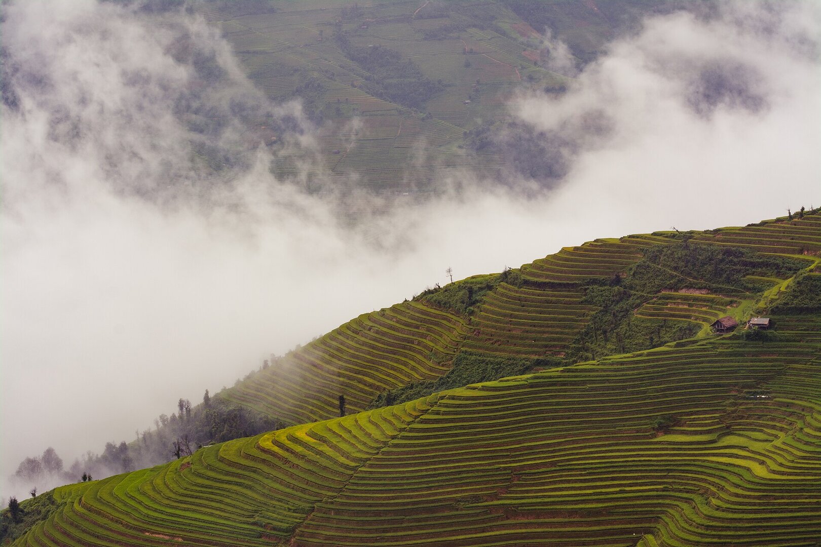
The terraces are built on very steep slopes at the foot of the Hoàng Liên Sơn range, at an elevation above 1,000 m; the area has no large river, so water is channelled from mountain streams into the highest plot and spills down gradually to the lower ones — the shape of the fields is closely tied to the network of streams. The plots here are usually narrow, in many places wide enough for only one or two harrow passes, but very long and curving around whole hills.
Busy and quiet times
These are working rice fields farmed by Hmong households — most of the local residents — not a park or a sightseeing site with its own paths. Compared with better-known spots in the area, this stretch of terraces is usually emptier and quieter; the golden season and festivals can reverse that.
Photographs
3 of 3 on fileThe story
De Xu Phinh Rice Terraces — What the Past Left, and What People Still Grow On It
Picture yourself on a mountainside below the Hoang Lien Son range, above 1,000 m, looking down into a valley. Nothing here is naturally flat. The only flatness you see was made by people: fields so narrow that many are barely wide enough for one or two passes of a plough, yet so long they curl all the way around a hill. A stream runs through the valley floor.
Vibe
Tags
Source
This place's dossier was collected and cross-examined by Vietlume's thiennhien (nature) agent set on 17 Sep 2026. The special national monument ranking and the 2007 national scenic-site milestone come from Tuổi Trẻ (31 Dec 2021), cross-checked against the Lào Cai provincial portal. The description of how water is channelled from stream gullies, the form of the terraced plots, the Hmong (người Mông) as the farming people and the distance to Hà Nội come from the Ministry of Culture, Sports and Tourism (11 Nov 2025). The water-filled season and the fact that Dế Xu Phình is named alongside La Pán Tẩn and Chế Cu Nha come from Báo Lào Cai (2024). The ripe-rice season, Đồi Mũi Giày, the bamboo bridge down into the valley and the remark ‘quiet, not crowded’ come from VnExpress (26 Sep 2024) — all four appear only in this article. The single route of National Highway 32 and the note about the pass road on rainy days come from VnExpress (2020); the risk of the rainy and flood season from VOV; the ongoing landslide-repair works on Khau Phạ pass from Dân Việt (17 Aug 2026). The change of administrative units follows Resolution 1673/NQ-UBTVQH15 of 16 Jun 2025. Several widely circulated claims were rejected and left off the page: every figure for entrance fees and motorbike-taxi prices (traced to two articles from 2020–2021, the 2026 pages only copy them); the elevation of 1,200–1,300 m and the distance of 19 km to the centre (found only on general travel pages); the area of Dế Xu Phình alone (the circulating figures cover different extents); the description ‘interspersed pine forest’ (it is the general landscape of the whole monument); the measurements of the landslide in early Oct 2025 (a temporary state, already repaired); and the harvest-season window ‘between May and October’ on the provincial government page, because it contradicts the area's single rice crop. The coordinates are currently a region-level anchor point, not a destination that can be navigated to. Photos: Gió Đông (Public domain) and VŨ HÙNG (CC BY-SA 3.0) via Wikimedia Commons.
Place data is compiled from many sources across the internet by a team of automated AI agents that collect, enrich, check, challenge, score, edit, review and verify it.
Ratings & comments
Anyone can read. Sign in to rate, comment and like.