Mù Cang Chải, Lào Cai · Nature
Mu Cang Chai
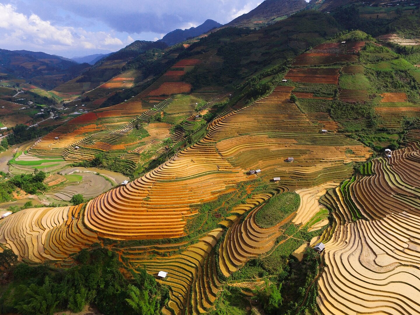
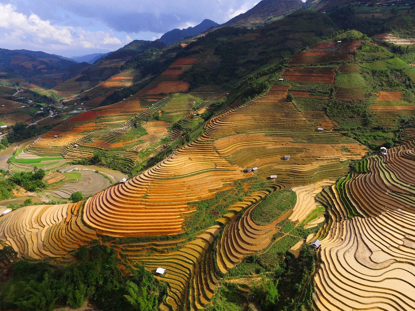
The rice terraces of Mù Cang Chải were carved and kept by Mông families over many generations. They are now a special national monument that is still planted and harvested — and the best season to see them coincides with the landslide season on the only road in.
01What people come for
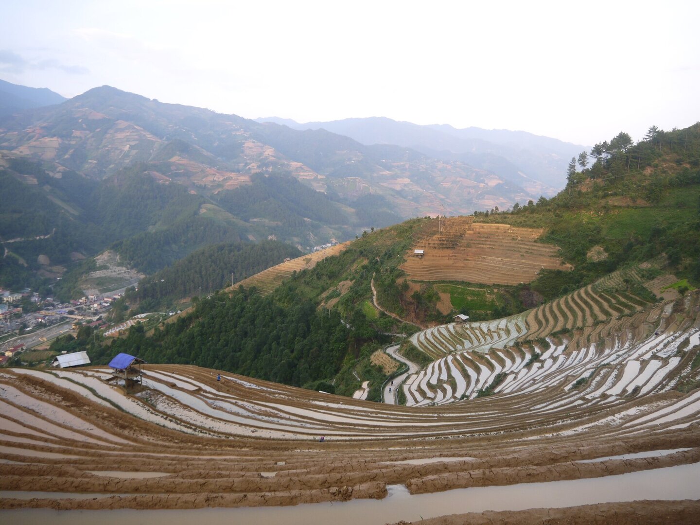
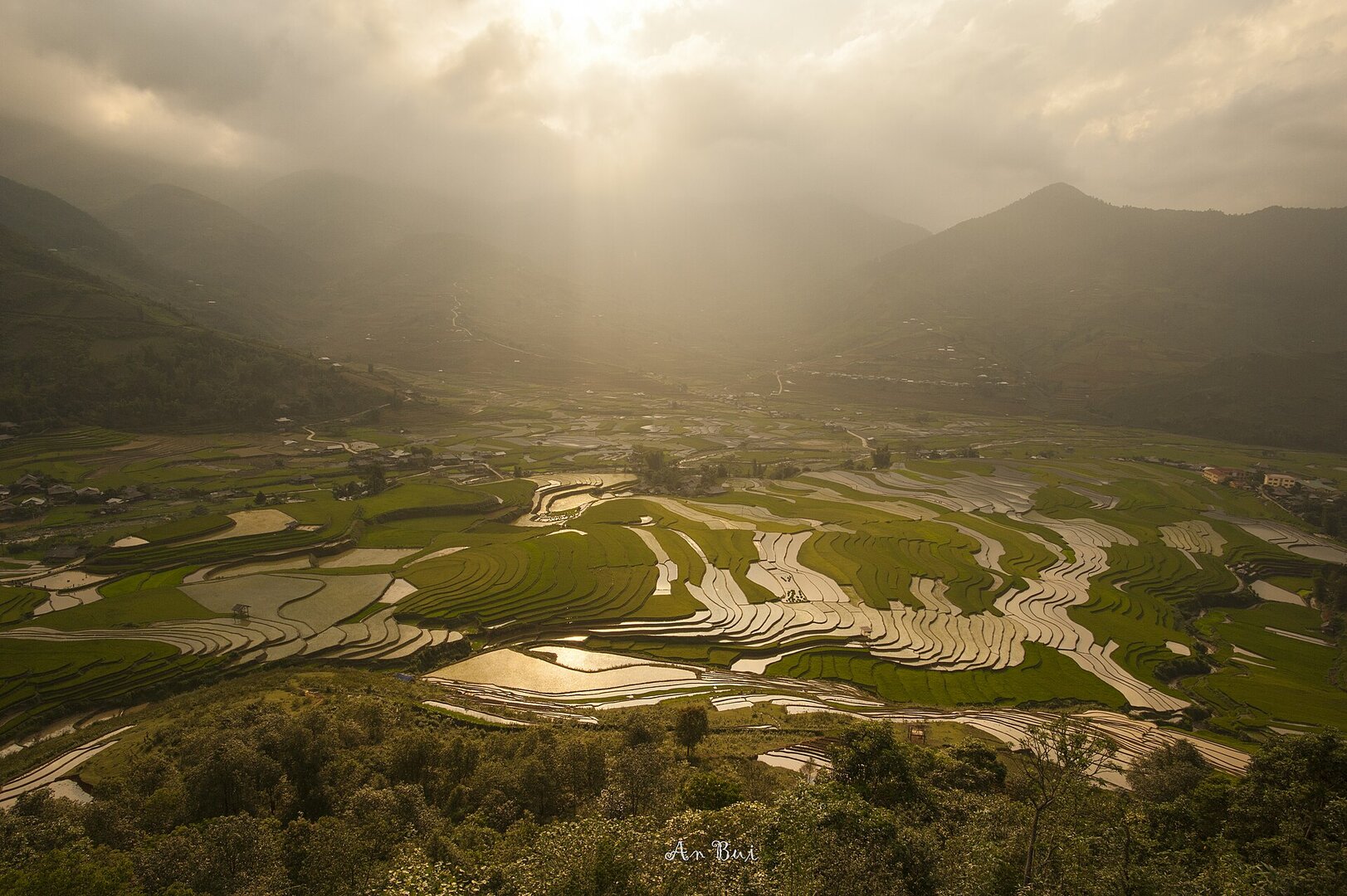
Three distinct seasons: ripe rice from the second half of September into October, the water-filled season from late May to early June when the field surfaces reflect the sky, and late December for the wild peach blossom season. The terraced-field area was ranked a special national monument at the end of 2019, and the province received the certificate at the end of 2021; the paragliding event 'Bay trên mùa vàng' is held annually at the Khau Phạ pass just as the fields turn golden (VietnamPlus).
Getting there and around
There is only one road in: National Route 32 over the Khau Phạ pass, about 300 km from Hà Nội. The viewpoints are separate side branches off the highway rather than a closed loop, and the last stretch up the hill usually means a local motorbike taxi or a steep walk; each viewpoint charges its own entry fee, with no single ticket for the whole area.
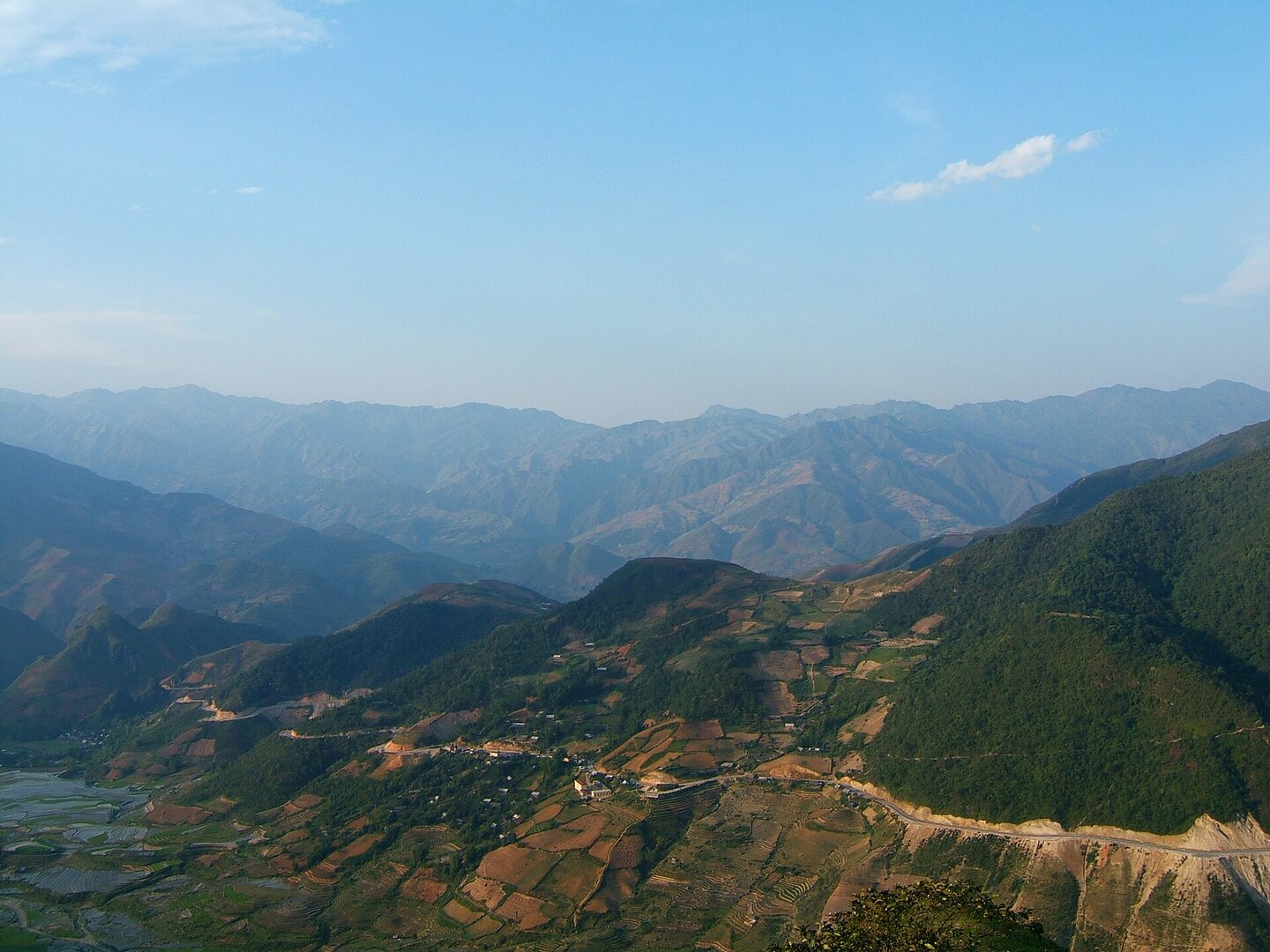
Gió Đông (Wikipedia tiếng Việt) · Public domain (PD-self) · source
Before you go
The viewing window is very narrow: the moment the rice is at its most golden is also when locals begin harvesting, and the rice ripens unevenly between valleys, so each area has its own timing; the water-filled season has failed some years because of drought, and in one year the fields at La Pán Tẩn were left bare in the middle of the season. The best season is also the worst for the roads: rain causes repeated landslides on the access route, and the landslide peak coincides with the ripe-rice season. At the end of Sep 2025 the Khau Phạ pass area had dozens of slide points, one of which swept away about 30 m of road surface, cutting traffic and forcing many tour groups to cancel. Because National Route 32 is the only access road, a blockage at one point means losing the way in, so check road conditions right before you go. Next to the fields is the Mù Cang Chải Species and Habitat Conservation Area, with primary forest and a population of black gibbons; no document has been found saying which zones visitors may enter, so do not go in on your own. As of this review there is still no official guidance on rescue, on-site medical care or safety conditions for paragliding.
What this place is
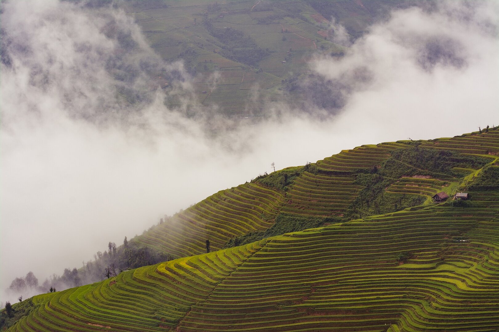
The terraced-field area lies at the foot of the Hoàng Liên Sơn range, with strongly dissected terrain and steep slopes; there is no large river, only a dense network of streams. That same stream network feeds the fields and is also the path of flash floods and torrents in heavy rain. The protected field area spreads across many highland communes rather than being a single spot, and the Khau Phạ pass at the gateway is often wrapped in cloud.
Busy and quiet times
Most residents are Hmong, and the terraced fields are works they built and have kept up over many generations (Lào Cai provincial portal, page on the special national monument dossier). Visitors come mainly by season: landscape photographers and groups chasing the ripe-rice season, in numbers large enough that one road landslide cancelled trips in bulk.
Eating
When the sticky rice ripens it is the green-rice-flake (cốm) season in Tú Lệ: there is a cốm festival and the steps of making cốm are open for visitors to watch and join in directly — available only in season, not year-round (VietnamPlus, news item on the Mù Cang Chải experience season).
Photographs
15 of 15 on fileKhoitran1957 · CC BY-SA 4.0 · source
Vietnam Photo Tours | An Bui · CC BY 2.0 · source
Văn Ngọc Tăng (langthangdaydo) · CC0 1.0 · source
Gió Đông (Wikipedia tiếng Việt) · Public domain (PD-self) · source
Victor311 · CC BY 4.0 · source
Tiên Ông · CC BY-SA 3.0 · source
VŨ HÙNG · CC BY-SA 3.0 · source
Vietnam Photo Tours | An Bui · CC BY 2.0 · source
Doan Tuan (danny_pham93) · CC0 1.0 · source
Viethavvh (Wikipedia tiếng Việt) · Public domain (PD-user-w) · source
Tiên Ông · CC BY-SA 3.0 · source
Viethavvh (Wikipedia tiếng Việt) · Public domain (PD-user-w) · source
Tiên Ông · CC BY-SA 3.0 · source
The story
Mù Cang Chải: Terraces Built by Generations, Still in Use
Picture yourself stopping on a high mountainside below the Hoàng Liên Sơn range, and realising the whole slope is not forest. It is ruộng bậc thang — rice terraces, step after step from mid-slope almost to the ridge, each one curving to the exact shape of the land. No architect signed it. It was built by Mông people, who make up most of the population here, and kept by generations who went on farming it. Have you ever stood in front of a heritage site whose makers are still at work on its surface?
Vibe
Tags
Source
The Mù Cang Chải area profile was built from several source layers, cross-checked on 17 Sep 2026. The current administrative unit comes from an OpenStreetMap/Nominatim reverse lookup at the exact pinned coordinates (Mù Cang Chải commune, Lào Cai province — before 1 Jul 2025 it was Mù Cang Chải district, Yên Bái province). The ranking dossier as a special national monument follows Tuổi Trẻ of 31 Dec 2021: the decision was signed on 31 Dec 2019, while the end of 2021 was the certificate ceremony — we rejected the date 31 Dec 2021 that many pages wrongly copy as the issuing date, including a provincial portal page that itself mixes the two dates. The ripening rice season follows Nhân Dân newspaper; the flooded-terrace season, the wild peach blossom season, the distance from Hà Nội and the single access road follow VnExpress's Mù Cang Chải travel guide (published 9 Sep 2020, updated 14 Jan 2026); the risk of drought spoiling the flooded-terrace season and how to reach the viewpoints follow two other VnExpress articles. The landslide warning that coincides with the golden season comes from VnExpress of 2 Oct 2025 (the late Sep to early Oct 2025 landslides around the Khau Phạ pass). The make-up of the population follows the Lào Cai provincial portal; the nature reserve and the black crested gibbon follow Báo Chính phủ; paragliding and the Tú Lệ green-rice-flake (cốm) season follow VietnamPlus; the terrain features and the Khau Phạ pass follow Vietnamese Wikipedia. We deliberately do NOT publish the following figures because sources contradict each other or they go stale fast: the area of the terraced fields (three sources give three figures with three different meanings), the number of species and the area of the nature reserve, sightseeing fees and motorbike-taxi prices (the original figures date from 2020–2021, and every 2026 page merely copies them), and every km marker or count of landslide spots — those are transient states, not facts about the place. Photos come from Wikimedia Commons, each with its author, licence and source URL.
Place data is compiled from many sources across the internet by a team of automated AI agents that collect, enrich, check, challenge, score, edit, review and verify it.
Ratings & comments
Anyone can read. Sign in to rate, comment and like.