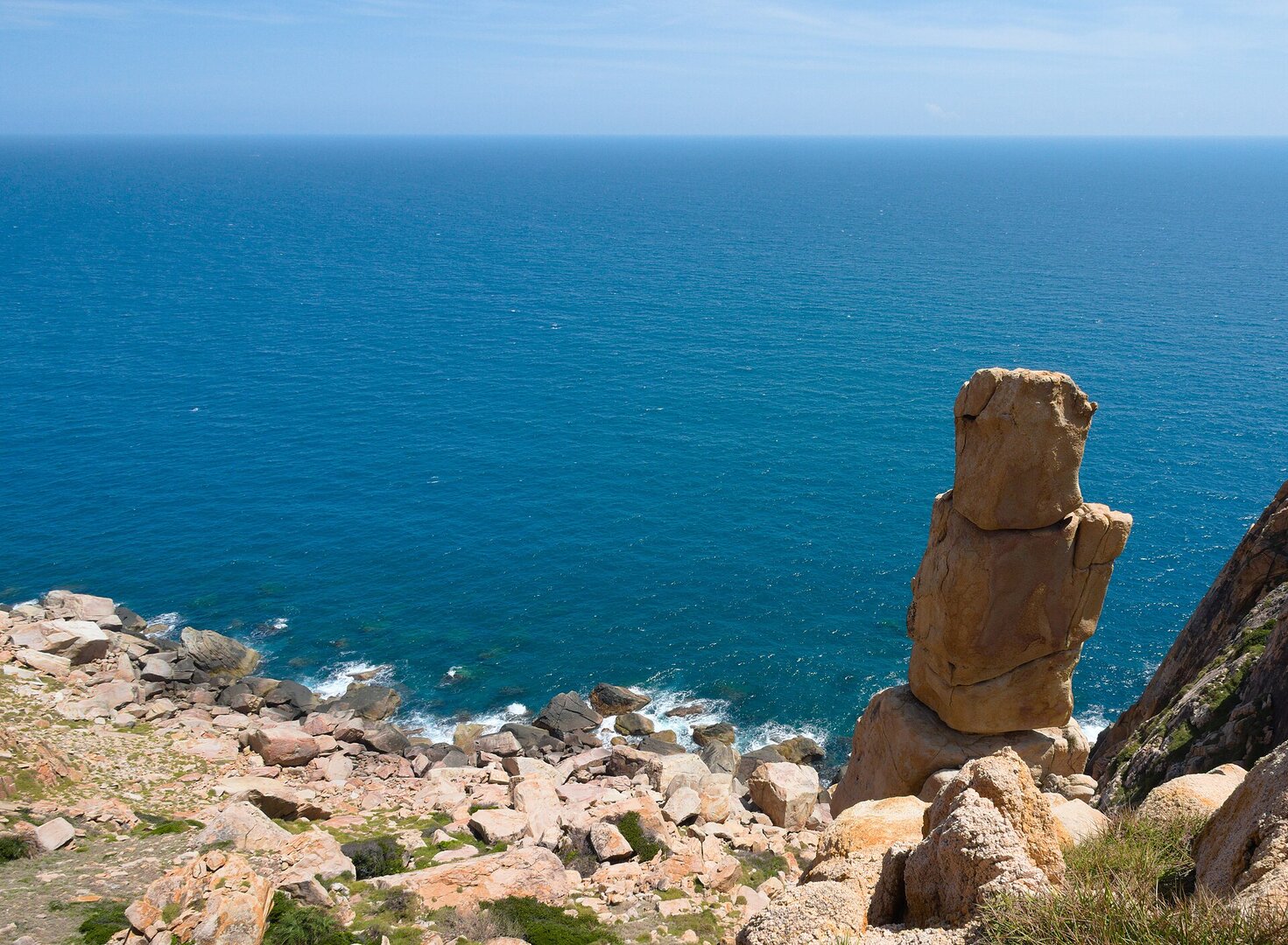
Photo: Dotrihieu · CC BY-SA 4.0
Khánh Hòa · Nature
Nui Chua National Park
Picture a Hoàng Cầm stove still lying in the forest, on a dry mountain block bounded by sea on three sides.
What people come for
People come here to trek through the dry forest and up to the summit of Núi Chúa (also called Cô Tuy, 1,039 m), to take the Hang Rái – Công viên Đá route, to take a boat tour of Vĩnh Hy bay, and to snorkel and dive among the corals in the park's waters. Black-shanked douc langurs live in the park, but the Management Board itself says you are not sure to see them.
Lam Tr Th · CC BY-SA 3.0 · source
Illustrated map
Outline, roads and the islets around come from OpenStreetMap. Each pictogram is a verified point; where they crowd, they are moved apart with a dot at the true spot.
Getting there and around
The headquarters and the park's Tourism Centre are in Thái An hamlet, Vĩnh Hải commune, Khánh Hòa province. On the grounds there is a 10-room guesthouse and a canteen. Hang Rái is about 30–35 km by road from the centre of Phan Rang – Tháp Chàm along the coastal route. The park charges an entrance fee; Hang Rái and Công viên Đá have entrance tickets.
Before you go
You may enter the forest only after buying a ticket, registering personal information and having travel insurance. On the deep routes you must go with a guide or a ranger, and you may not organise your own trekking or camping. People with heart disease, blood-pressure problems or severe asthma, and pregnant women, may not take the deep routes. Fires are allowed only at the designated campsite, because the dry forest burns very easily in the dry season (same rules). Rain is concentrated in the last months of the year, when the sea is roughest; in heavy rain the park closes the forest routes and the pier. The beaches are wild and no source shows that lifeguards are present; OSM records that Bãi Chà Là has no lifeguard. Hang Rái has sinkholes in the rock surface and there is a fence keeping people out of the dangerous area. From 23 Sep 2026 the park has temporarily suspended sightseeing, trekking, camping and the boat pier, and as of 24 Sep 2026 there is no announcement of reopening (TB 107/TB-TTDLGDMT).
Lam Tr Th · CC BY-SA 3.0 · source
What this place is
A single mountain mass bordered by sea on three sides, covered in dry-adapted forest and thorny scrubland; evergreen forest remains only in the north at higher elevation. The Management Board describes the place as a meeting point of 'Forest – Sea and semi-desert'. Together with the Núi Chúa Marine Protected Area, the park is the core zone of the Núi Chúa World Biosphere Reserve, recognised by UNESCO in 2021. The area was once named 'Phan Rang dry forest' in the 1986 list of protected forests and became a national park in 2003.
Busy and quiet times
The cross-summit route is about 22 km long in a single day; the park encourages visitors aged 18 and over in good physical shape. The Hang Rái – Công viên Đá route is recommended for children from 7 years old, and the Đá Đỏ peak is graded easy for beginners. On holidays such as 30 April, Vĩnh Hy pier is packed and visitors queue for boats.
Photographs
P.T.Đ · CC BY-SA 4.0 · source
Phương Huy · CC BY-SA 4.0 · source
Lam Tr Th · CC BY-SA 3.0 · source
Chim Heiki · Public Domain Mark 1.0 · source
Suriya Vij · Public domain (PD-self) · source
Suriya Vij · Public domain (PD-self) · source
Lam Tr Th · CC BY-SA 3.0 · source
Lam Tr Th · CC BY-SA 3.0 · source
Pddang · CC BY-SA 3.0 · source
Karel Bilek · CC BY-SA 4.0 · source
Phương Huy · CC BY-SA 4.0 · source
Dotrihieu · CC BY-SA 4.0 · source
Павлик Лисицын (iNaturalist) · CC BY 4.0 · source
Pddang · CC BY-SA 3.0 · source
Suriya Vij · Public domain (PD-self) · source
Hưng Hồ Bá · CC BY 2.0 · source
Hải Âu Cần Thơ · CC BY-SA 4.0 · source
The story
Núi Chúa National Park: what the dry forest has kept
Picture a Hoàng Cầm stove — the smokeless field kitchen of Vietnam's war years — still lying in the forest, along with stretches of trenches from the CK19 war zone, on a dry mountain block bounded by sea on three sides. This is Núi Chúa National Park in Khánh Hòa province, where forest, sea and semi-desert meet in one of the driest regions of Vietnam. The past here comes in layers. The deepest is rock: a magma base of andesite, rhyolite and granite, and the ancient coral terrace at Hang Rái, where waves wash over a flat rock shelf and run off in small cascades. The nearer layer is people: coastal fishing villages hold boat races, hát lăng singing and the worship of Cá Ông, the whale; Cầu Gãy, a village of the Raglai people, runs community tourism with a handicraft group and the Mã la dance.
Vibe
Tags
Source
Information about the park comes mainly from the official page of the Núi Chúa National Park Management Board and the new page of the Núi Chúa – Phước Bình Management Board, covering: the address of the headquarters, the history of its formation, the tour routes, the visiting rules, accommodation and the notice of fees. All were re-read on 24 Sep 2026. The rules for entering the forest and the two notices of suspension of 23 Sep 2026 come from PDF documents the Management Board posted on Google Drive (Rules 10a of 12 Jan 2026, notice 107/TB-TTDLGDMT). The merger of the two management boards from 1 Jul 2025 comes from the Khánh Hòa Official Gazette. The year it was recognised as a biosphere reserve comes from the UNESCO page. The coast, the number of beaches, the coral species and the layer of wartime base sites come from the page of the Department of Nature Conservation and Biodiversity (nbca.gov.vn). The terrain, geology, climate and waves come from the Vietnamese Wikipedia. Sea turtles and the turtle nesting season come from Tuổi Trẻ (6 Aug 2024). Hang Rái comes from Nhân Dân (6 May 2022). The Bãi Thùng warning comes from Mực Tím (8 Aug 2024). Life jackets, diving rules and the season to go come from VnExpress. The busy times come from Tuổi Trẻ (30 Apr 2025). The road ĐT702 comes from Người Du lịch. The park boundary and the coordinates of points on the map come from OpenStreetMap. Some facts were rejected: the park's area (four sources give four different figures), the specific date of UNESCO recognition (sources differ by one year), the distance 'nearly 7 km to Vĩnh Hy bay' (OSM geometry shows the bay is only about 230 m from the boundary), the price of the electric-cart ticket and the shuttle electric-cart service (only one undated aggregator page), the species quản đồng (sources list it differently), and the figure of 14,500 visitors (which is for the whole commune, not the park alone).
Place data is compiled from many sources across the internet by a team of automated AI agents that collect, enrich, check, challenge, score, edit, review and verify it.
Ratings & comments
Anyone can read. Sign in to rate, comment and like.