Mộc Châu, Sơn La · Nature
Moc Chau Plateau
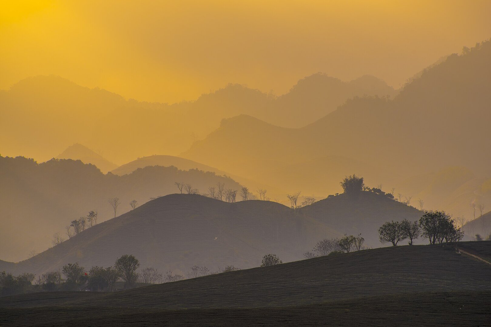
A plateau in Mộc Châu, Sơn La — not a single attraction with an entrance gate but a wide expanse crossed by National Highway 6, where visitors move between separate stops: tea hills, pine forest, a plum valley, waterfalls, caves and villages. A region of tea, fruit trees and dairy cattle, changing its look with the flower and fruit seasons.
Photo: Linh Pham (Unsplash: linharex) · CC0 1.0
What people come for
People come for the seasons. The start of the year is the flower season: plum blossoms white, mustard flowers yellow, plus peach and ban flowers, along with persimmon orchards, ripe orange orchards and strawberries; the local authorities identify spring as the best time of the year. Around late spring to early summer the hậu plum orchards come into their main harvest and visitors carry a lù cở basket to pick their own and eat right in the orchard, in the Nà Ka valley and the villages of Pa Phách and Pa Khen. Winter is the season of the mustard-flower hills. The tea hills are most beautiful at first light and at dusk, when the tea fields hide in the mist; Dải Yếm Waterfall has the most water from midsummer to early autumn. The area also has the Bản Áng pine forest, with old pines around a natural lake, and Hang Dơi (Bat Cave) — a scenic site ranked nationally in 1998 (Sơn La provincial heritage list).
Vietlong1220 (Wikimedia Commons) · CC BY-SA 4.0 · source
Getting there and around
From Hà Nội it is nearly 200 km along National Road 6, by scheduled coach or by driving yourself; there is no airport and no railway to the site. The plateau itself does not sell an entry ticket; each spot inside charges separately — the plum orchards in harvest season charge a very low fee that includes picking and eating on the spot, while the waterfalls and amusement areas have their own tickets.
Before you go
The seasonal markers here shift from year to year because they wait on the weather: an orchard owner in Nà Ka says that in a leap year the plums ripen later than usual, so do not aim for a fixed week. The way up is National Road 6, with many steep passes and dangerous bends, often thick fog and slippery road surface — most of all at night, in the morning and in winter when temperatures drop, with episodes stretching dozens of kilometres, day and night. The risk of falling rocks and embankment landslides on the route is real all year, not only in the rainy season: the landslide that buried the road and killed three people at Thung Khe Pass in Dec 2025 happened when there was no rain. Even inside Mộc Châu itself, prolonged heavy rain has caused local flooding and dangerous fast-flowing water on National Road 6 and National Road 43 — the season when the waterfalls look best coincides exactly with the season of slippery roads. No source yet speaks about rescue services or whether swimming is permitted at the waterfalls, about the depth of the water at the foot of the falls, or about safety in Hang Dơi (Bat Cave) and the Ngũ động Bản Ôn caves; silence here should not be read as safety.
What this place is
This is a plateau — a broad stretch of upland in the Northwest mountains, not a destination with an entrance gate: National Road 6 runs through it, while the waterfalls, caves, tea hills, pine forests and plum valleys are scattered on both sides, and you need a vehicle to get from one spot to the next (Sơn La Provincial Party Committee page). The climate is subtropical highland, cool all year; the days are sunny and warm but the nights get cold and often foggy.
Busy and quiet times
Busiest around National Day on 2 Sep, when the locality holds a culture and tourism week lasting several days; the fruit-picking season and Tết are also busy. The Thái and the Mông are the ethnic minorities that make up the majority here, and the year has a series of seasonal festivals — peach blossom, ban flower, Hết Chá, orchid, hot-air balloon (Sơn La Provincial Party Committee page).
Photographs
9 of 9 on fileLinh Pham (Unsplash: linharex) · CC0 1.0 · source
Vietlong1220 (Wikimedia Commons) · CC BY-SA 4.0 · source
Linh Pham (Unsplash: linharex) · CC0 1.0 · source
Trần Kiên Trung · CC BY 2.0 · source
DangTungDuong (Wikimedia Commons) · CC BY-SA 4.0 · source
Tuấn Nguyễn (500px) · CC BY-SA 3.0 · source
Vietlong1220 (Wikimedia Commons) · CC BY-SA 4.0 · source
Vietlong1220 (Wikimedia Commons) · CC BY-SA 4.0 · source
Viethavvh (vi.wikipedia) · Public domain (PD-user) · source
The story
Moc Chau: A Plateau Shaped by the People Who Stayed
Picture yourself standing in a tea field before the light has fully arrived, mist sitting on the leaves until the sun climbs. Moc Chau is not an attraction with a gate and a ticket booth. It is a plateau — a broad upland floor in Vietnam's northwestern mountains, in Son La province — with National Highway 6 running straight through it, while the waterfalls, the cave, the tea hills, the pine woods, the plum valley and the villages are scattered on either side. Getting from one to the next means getting back in a vehicle.
Vibe
Tags
Source
This place profile was collected and verified by Vietlume's nature agent set on 17 Sep 2026. The shape of the area, the list of stops within it, the Áng village pine forest and the chain of seasonal festivals come from the Sơn La Provincial Party Committee website. The 2024 recognition as a National Tourism Area (Decision 1077/QĐ-BVHTTDL of 22 Apr 2024) was cross-checked against an excerpt of the decision on luatvietnam.vn and a Hànộimới news item of 23 Apr 2024; the planning basis of that decision is Decision 2050/QĐ-TTg of 12 Nov 2014 — not 128/QĐ-TTg (2019), as one summary wrongly states. Seasons: the early-year flower season and the authorities' assessment of 'spring at its most beautiful' come from Nhân Dân newspaper of 15 Jan 2026; the plum-ripening season, the fruit-picking season, the winter mustard-flower season, the tea hills and the water season at Dải Yếm waterfall come from Sơn La newspaper. Climate and how to get there come from VnExpress's Mộc Châu travel guide. Peak visitor periods come from VietnamNet (2026). The population layer comes from Vietnamese Wikipedia, with the tea and dairy-cattle part independently confirmed by Sơn La newspaper. The Hang Dơi scenic site and the Đồn Mộc Lỵ relic come from the Sơn La provincial list of ranked relics. Safety on the access road: fog and slippery road surface on National Highway 6 come from Pháp Luật newspaper; the Thung Khe pass landslide of Dec 2025 comes from Tuổi Trẻ of 15 Dec 2025; flooding and fast-flowing water within Mộc Châu come from VOV. Rejected, and why: the average elevation — two layers of sources disagree (800–1,000 m according to Hànộimới 23 Apr 2024, 1,050 m according to Wikipedia) and no surveying document settles it, so no figure is given; the same goes for the height of the Pha Luông peak (three values are in circulation). Plum-orchard ticket prices and waterfall heights were dropped under the set's rules — prices change by year and by orchard. The border-guard registration procedure for climbing Pha Luông appears only on travel blogs, with no notice from any competent authority, so it is not included — this is a safety matter, all the more reason not to write it from a blog. The rare species of the Xuân Nha Nature Reserve are not attributed to the plateau: the reserve lies in the same area but is not the expanse this place covers. Administrative level: the district level was abolished from 1 Jul 2025. According to the document on the rearrangement of administrative units of Sơn La province published on xaydungchinhsach.chinhphu.vn on 23 Jun 2025, Đông Sang ward and Mộc Sơn ward merge into Mộc Sơn ward (Article 66), and Cờ Đỏ ward merges into Thảo Nguyên ward (Article 68) — so the Nà Ka plum valley now belongs to Thảo Nguyên ward, while the coordinate anchor reverse-geocodes to Mộc Sơn ward. We leave the commune-level column empty because there is no source mapping each point; the address reads only 'Mộc Châu, Sơn La'. Still open, not established: the rainy and dry seasons by month, the dimensions of the plateau, and the entire on-site safety side (rescue at waterfalls, water depth, safety in caves).
Place data is compiled from many sources across the internet by a team of automated AI agents that collect, enrich, check, challenge, score, edit, review and verify it.
Ratings & comments
Anyone can read. Sign in to rate, comment and like.