Photo: minhphuc_99kdd (EXIF copyright ghi: Minh Phuc Nguyen) · Public Domain Mark 1.0
Bản Áng, phường Mộc Sơn, Sơn La · Nature
Ban Ang Pine Forest
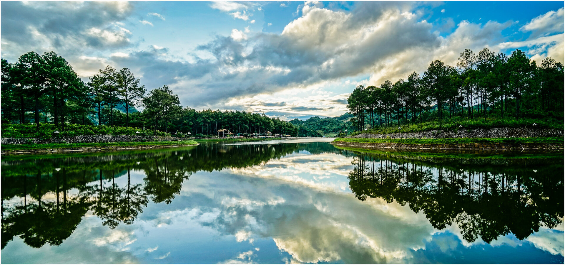
A pine-filled basin on the Moc Chau plateau, where a White Thai hamlet still keeps its March festival while most of the grounds have become a gated, operated resort.
What people come for
Walking slowly around the lake under the pine canopy, camping at a separate camping area under the forest facing the water, and going in March exactly, when ban flowers bloom across the region and the village holds its festival.
Getting there and around
About 2 km from the centre of Mộc Châu along National Road 43. Inside the grounds a path runs around the lake; get around on foot, by bicycle or by electric cart. On-site accommodation includes stilt houses, bungalows under the pine canopy and a hotel.
Before you go
This is not a forest open for free roaming: since 2018 most of the grounds have been a gated resort and recreation area, invested in and operated by a company. It has not been established whether this place charges an entrance fee — the province's tourism promotion portal labels it 'Free' and leaves the ticket field blank, other pages say the opposite, and the official page has no ticket section. No visiting rules, opening hours or water-safety guidance have been published either: no source says how deep the lake is, whether swimming is allowed, or whether there is a lifeguard or compulsory life jackets — so keep an eye on small children at the lake edge. Three seasons need careful preparation, all three being province-level warnings that do not name this place specifically: in midwinter, severe cold with frost and rime in the high mountain areas (VietnamPlus); in the highland flood season, flash floods, landslides and cut-off roads, and the authorities may suspend activities in areas that cannot be made safe; in the dry season, the province raises forest fire warnings to the dangerous and extremely dangerous levels — this is a pine forest, so any use of fire, including at the camping area, must follow on-site guidance.
What this place is
A basin on the Mộc Châu plateau: pine forest spreads down from red-earth hillsides, wrapping around a natural lake lying in the low floor. The climate is cool all year round even in midsummer, and the range within a day is very large — early morning mist covers the lake surface and the pine canopy, noon sun is harsh over the forest, the afternoon is chilly, and mist settles in the evening.
Busy and quiet times
Right next to the pine forest is a White Thai village that runs community tourism: homestays in traditional stilt houses, a tourism cooperative and performance troupes serving tour groups. In March, the local community itself opens the Hết Chá Festival — a nationally listed intangible cultural heritage, with the raising of a ceremonial pole and xòe dancing; the date shifts from year to year.
Eating
There is a restaurant in the grounds serving Northwestern dishes.
The story
Ban Ang Pine Forest — what the past left, what people built
Picture yourself walking down into a basin. Pines spill from red-earth slopes and stop at the edge of a wide lake lying in the hollow below. Early morning, mist covers the water and threads between the pine crowns; midday the sun is hard on the forest; afternoon light thins and the air turns cool; by evening the mist settles again. It stays cool here all year, even in midsummer — that is what the plateau gives, not something anyone made.
Vibe
Tags
Source
This place profile was built from four layers of sources. The administrative unit comes from the main text of Resolution 1681/NQ-UBTVQH15 published on the Government Portal (adopted 16 Jun 2025): Đông Sang ward and Mộc Sơn ward merged into Mộc Sơn ward from 1 Jul 2025 — so every older document that says 'Đông Sang commune, Mộc Châu district' is out of date, and Báo Sơn La in 2026 already uses 'Bản Áng Pine Forest, Mộc Sơn ward'. Its status as part of the Mộc Châu National Tourist Area follows Decision 1077/QĐ-BVHTTDL dated 22 Apr 2024 of the Ministry of Culture, Sports and Tourism. The terrain, the distance to the centre and the rapeseed-flower season around the area were read from the Tourist Destinations page of the Sơn La Provincial Investment Promotion Centre (the page is undated and still uses the pre-reform names, so it is used only for geometry, not for administrative information). Climate, the rhythm of the day, the operator since 2018, the restaurant and the camping area come from Báo Pháp luật Việt Nam 2020, Báo Sơn La 14 Mar 2023 and a Báo Sơn La item of Mar 2026 on the Hết Chá Festival; the three seasonal warnings (severe cold and frost, heavy rain with floods and landslides, forest fire in the dry season) are province-level bulletins from VietnamPlus and Báo Sơn La, none of which names this place. Photo: the lake and pine forest, by Minh Phuc Nguyen (minhphuc_99kdd) on Flickr, Public Domain Mark 1.0, taken on 18 Sep 2015 — that is BEFORE the 2018 construction, so this frame does not reflect the current state of the grounds. Things that were rejected, written down so nobody has to redo them: the 3 ha lake figure (three sources copy the same 2023 article; two independent layers give about 5 ha), a fixed festival schedule of 26–28 Mar (2023 was 24–25 Mar, 2026 was 27–28 Mar), the distance of 3.5 km (two independent layers give about 2 km), every ticket price figure, and the strawberry season of another business wrongly attributed to this place. Still not established: whether a fee is charged, the forest area, the pine species and planting year, opening hours, visiting rules and all water-safety guidance.
Place data is compiled from many sources across the internet by a team of automated AI agents that collect, enrich, check, challenge, score, edit, review and verify it.
Ratings & comments
Anyone can read. Sign in to rate, comment and like.