Đà Nẵng · Island · Nature
Cham Islands
Picture the old town of Hội An you may have walked through, then look out to sea: about twenty kilometres offshore lies a cluster of islands holding a pagoda, a shrine to the founder of the bird's-nest trade, and the jar burials of people who lived here before the Sa Huỳnh culture.
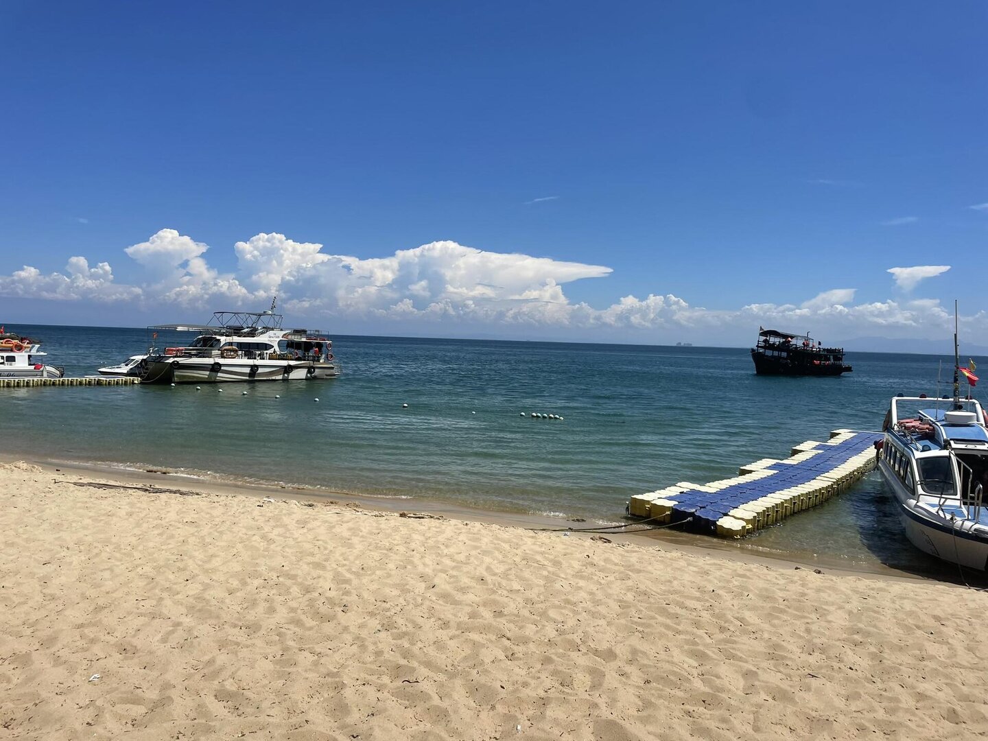
Photo: Theguywithkpdomain · CC0 1.0
What people come for
Day visitors mainly come to snorkel over the coral, walk on the seabed or scuba dive, all through licensed operators. Bãi Ông is the lunch stop and the starting point for dives. Swimming and diving are only organised in the coastal waters of Bãi Xếp, Bãi Chồng, Bãi Bìm, Bãi Hương and Hòn Dài; part of the sea around Hòn Tai belongs to a strictly protected zone. In midsummer, red ngô đồng (Chinese parasol) flowers bloom all over the island for about a month, most of all on the western slopes.
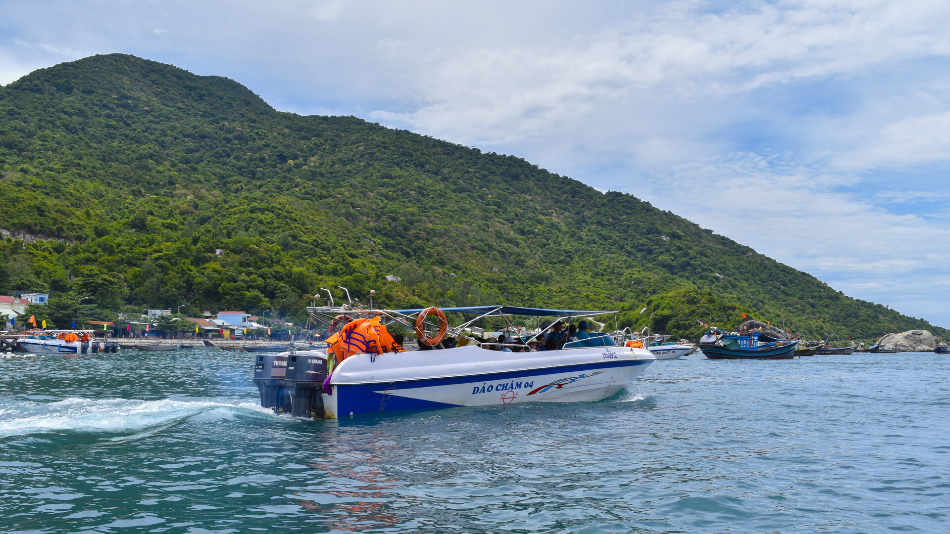
Nico Caramella · CC BY 2.0 · source
Illustrated map
Illustrated map
Outline, roads and the islets around come from OpenStreetMap. Each pictogram is a verified point; where they crowd, they are moved apart with a dot at the true spot.
Getting there and around
The island can only be reached by high-speed boat from Cửa Đại port, about 15 km away, a 15–20 minute ride; wooden boats carry only cargo and local residents. On the island you get around on foot, or by renting a motorbike or hiring a local motorbike taxi; the roads are small and narrow with many sharp bends. Since 10 Jun 2026 a reserve visiting fee is charged per person per visit, in addition to the boat ticket.
Before you go
You can go from about March to August; one 2026 source stretches this to September. September to February of the following year is the rainy and stormy season, and tourist boats usually stop running. Even in the good season, strong wind leads the port authority to ban boats: on 16–17 Jul 2026 about 300 visitors were stuck on the island for nearly a day. So allow spare time to get back to the mainland, wear a life jacket on the boat, when swimming and when diving, and do not assume any beach has lifeguards, since no source confirms that.
What this place is
Cù Lao Chàm is a cluster of eight islands. Only the largest island, Hòn Lao, has residents, living in three villages, Bãi Làng, Bãi Ông and Bãi Hương, and forest covers the slopes up to the highest peak at 517 m. In 2009 UNESCO recognised Cù Lao Chàm – Hội An as a World Biosphere Reserve. Since 2025 it has been a Nature Reserve covering both sea and natural forest, with more than 1,035 land species and about 1,309 marine species recorded.
Busy and quiet times
Most visitors go and return on the same day. For those who want to stay overnight, there are local homes and homestays around the fishing villages of Bãi Làng and Bãi Hương; Eo Gió, on the east side of the island about 3 km from Bãi Làng, is a place to watch the sunrise.
Eating
Ốc vú nàng (a local sea snail) is available all year, most abundant on full-moon days. Stone crab may only be harvested from early March to the end of July, so choose crab with an eco-label (regulations of the Cù Lao Chàm Marine Protected Area Management Board).
Photographs
19 of 19 on fileTheguywithkpdomain · CC0 1.0 · source
Nico Caramella · CC BY 2.0 · source
Robert Quan · CC BY-SA 4.0 · source
Bùi Đình Thiêm · CC BY-SA 3.0 · source
Lê Thy (Vietnamese Wikipedia) · Public domain (PD-user) · source
Lê Thy (Vietnamese Wikipedia), tải lại bởi Phó Nháy · Public domain (PD-user) · source
Julien Renoult · CC BY (iNaturalist, giấy phép của từng ảnh) · source
Duyenpaul (Wikivoyage, wts) · Public domain (PD-author) · source
Kok Leng Yeo · CC BY 2.0 · source
User:Blon · CC BY-SA 3.0 · source
yeowatzup (Kok Leng Yeo) · CC BY 2.0 · source
Viethavvh · CC BY-SA 3.0 · source
Julien Renoult · CC BY (iNaturalist, giấy phép của từng ảnh) · source
Reyes Martínez · CC0 1.0 · source
Wwhyte (William Whyte, Flickr) · CC BY-SA 2.0 · source
Soupybev · CC BY 4.0 · source
yeowatzup (Kok Leng Yeo) · CC BY 2.0 · source
minhduc_ly · Public Domain Mark 1.0 · source
User:Blon · CC BY-SA 3.0 · source
The story
Cù Lao Chàm: old traces on eight islands
Cù Lao Chàm (the Cham Islands) is not one island but eight. People live only on the largest, Hòn Lao — its highest peak 517 m, with natural forest, and three villages, Bãi Làng, Bãi Ông and Bãi Hương, at the foot of the hills. Today it is Tân Hiệp island commune, Đà Nẵng. Older Vietnamese names for it include Chiêm Bất Lao; Westerners of the past wrote it as Puliciam.
Vibe
Tags
Source
Information on the geography of the cluster of eight islands, the distance of about 15 km from Cửa Đại port and the Bãi Ông archaeological site comes from the Hội An Centre for Cultural Heritage Management and Conservation (12 May 2025). The nature-reserve regulations, the zones where swimming and diving are allowed (official letter of 23 Jan 2026), the ban on anchoring, the rock crab harvest season and the biodiversity figures (13 Mar 2026) come from the Management Board of Cù Lao Chàm Nature Reserve. The best season to visit and the rainy-storm season come from the Đà Nẵng tourism portal (6 Aug 2025) and the climate page of Đà Nẵng city. How to get to the island, accommodation, Eo Gió and ốc vú nàng (a local sea snail) come from the VnExpress guide (published 4 Jun 2024, updated 14 Jul 2026). Diving activities and the population of the three villages come from Báo Cần Thơ (17 Aug 2026). The visit fee and the Miếu Tổ nghề Yến (Temple of the Swiftlet-Nest Trade Ancestor, built in 1848) come from Báo Văn hoá (10 Jun 2026 and 13 Jul 2025). The boat bans come from Thanh Niên (17 Jul 2026), Nhân Dân and VOV. The 2022 speedboat capsizing comes from Báo Pháp luật. The ngô đồng (Chinese parasol tree) flowers come from SGGP (2026). The year Chùa Hải Tạng was built (existing since 1758, moved to its present site in 1848) and the island's old names come from Vietnamese Wikipedia. Some details were dropped: the figure of 18 km from Cửa Đại (it does not match when measured on the coordinates: 15.4 km), the area of Hòn Lao (two sources disagree), the number of coral species (292 and 135, too far apart, so only ‘hundreds of species’ is stated), the date of UNESCO recognition (26 May or 29 May 2009, only the year is kept), the 2017 list of dive sites (replaced by the 2026 official letter), the name ‘Miếu Thần Yến Sào’ and the year 1843 (English Wikipedia, which disagrees with the domestic press), and every money figure. There is currently no source on lifeguards or dangerous currents at each beach.
Place data is compiled from many sources across the internet by a team of automated AI agents that collect, enrich, check, challenge, score, edit, review and verify it.
Ratings & comments
Anyone can read. Sign in to rate, comment and like.